Area Overview for NE16 6BP
Photos of NE16 6BP
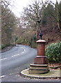
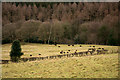
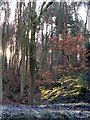
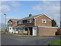
20 photos from this area
Area Information
Key information about the NE16 6BP including its size, population, and administrative classification.
- Area Type
- Postcode
- Area Size
- 10.7 hectares
- Population
- 1596
- Population Density
- 246 people/km²
House Prices in NE16 6BP
17
Properties
£100,325
Average Sold Price
£20,000
Lowest Price
£205,000
Highest Price
Showing 17 properties
| Address | Type | Beds | Baths | Last Sale Price | Last Sale Date | |
|---|---|---|---|---|---|---|
| 67 Bryans Leap, Burnopfield, NE16 6BP | house | - | - | £205,000 | Nov 2023 | |
| 65 Bryans Leap, Burnopfield, NE16 6BP | Semi-detached | 3 | - | £149,950 | Sep 2015 | |
| 54 Bryans Leap, Burnopfield, NE16 6BP | house | - | - | £20,000 | May 2014 | |
| 58 Bryans Leap, Burnopfield, NE16 6BP | Semi-detached | 3 | 1 | £73,000 | May 1999 | |
| 51 Bryans Leap, Burnopfield, NE16 6BP | Detached | - | - | £95,000 | May 1999 | |
| 57 Bryans Leap, Burnopfield, NE16 6BP | Semi-detached | - | - | £59,000 | May 1996 | |
| 60 Bryans Leap, Burnopfield, NE16 6BP | Detached | 3 | 1 | - | - | |
| 63 Bryans Leap, Burnopfield, NE16 6BP | Semi-detached | - | - | - | - | |
| 52 Bryans Leap, Burnopfield, NE16 6BP | Detached | - | - | - | - | |
| 55 Bryans Leap, Burnopfield, NE16 6BP | Detached | - | - | - | - |
Page 1 of 2
Energy Efficiency in NE16 6BP
Amenities
Schools
| Rank | School | Type | Entry gender | Ages |
|---|
Explore more schools in this area
Go to Schools tabDemographics
Household Size
Two person
most common
Accommodation Type
Houses
most common
Tenure
84
majority
Ethnic Group
White
most common
Religion
N/A
most common
Household Composition
N/A
most common
Age
47
median
Adults (30-64 years)
most common
Household Deprivation
N/A
with no deprivation
NS-SEC
42
in Lower managerial occupations
Explore more demographic insights in this area
Go to Demographics tabPlanning
Planning Constraints
- Flood RiskPremium
- Ramsar Wetland SitesPremium
- Area of Outstanding Natural BeautyPremium
- Protected Nature ReservePremium
- Protected WoodlandPremium