Area Overview for NE16 5YP
Photos of NE16 5YP
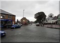
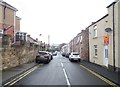
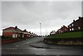
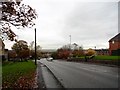
38 photos from this area
Area Information
Key information about the NE16 5YP including its size, population, and administrative classification.
- Area Type
- Postcode
- Area Size
- 3575 m²
- Population
- 1290
- Population Density
- 1505 people/km²
House Prices in NE16 5YP
10
Properties
£105,878
Average Sold Price
£44,950
Lowest Price
£203,500
Highest Price
Showing 10 properties
| Address | Type | Beds | Baths | Last Sale Price | Last Sale Date | |
|---|---|---|---|---|---|---|
| 42 Bullfinch Drive, Fellside Park, Whickham, NE16 5YP | house | - | - | £203,500 | Oct 2025 | |
| 39 Bullfinch Drive, Fellside Park, Whickham, NE16 5YP | Flat | 2 | 1 | £130,000 | Oct 2023 | |
| 38 Bullfinch Drive, Fellside Park, Whickham, NE16 5YP | Flat | - | - | £129,950 | Nov 2019 | |
| 35 Bullfinch Drive, Fellside Park, Whickham, NE16 5YP | Flat | - | - | £50,000 | Jan 2019 | |
| 36 Bullfinch Drive, Fellside Park, Whickham, NE16 5YP | Flat | - | - | £115,500 | Jun 2007 | |
| 43 Bullfinch Drive, Fellside Park, Whickham, NE16 5YP | Semi-detached | - | - | £154,000 | Apr 2005 | |
| 37 Bullfinch Drive, Fellside Park, Whickham, NE16 5YP | Flat | - | - | £60,000 | Apr 2001 | |
| 41 Bullfinch Drive, Fellside Park, Whickham, NE16 5YP | Semi-detached | - | - | £65,000 | Jun 1999 | |
| 34 Bullfinch Drive, Fellside Park, Whickham, NE16 5YP | Flat | - | - | £44,950 | Dec 1995 | |
| 40 Bullfinch Drive, Fellside Park, Whickham, NE16 5YP | Semi-detached | - | - | - | - |
Energy Efficiency in NE16 5YP
Amenities
Schools
| Rank | School | Type | Entry gender | Ages |
|---|
Explore more schools in this area
Go to Schools tabDemographics
Household Size
Two person
most common
Accommodation Type
Houses
most common
Tenure
73
majority
Ethnic Group
White
most common
Religion
N/A
most common
Household Composition
N/A
most common
Age
47
median
Adults (30-64 years)
most common
Household Deprivation
N/A
with no deprivation
NS-SEC
38
in Lower managerial occupations
Explore more demographic insights in this area
Go to Demographics tabPlanning
Planning Constraints
- Flood RiskPremium
- Ramsar Wetland SitesPremium
- Area of Outstanding Natural BeautyPremium
- Protected Nature ReservePremium
- Protected WoodlandPremium