Area Overview for NE16 5XU
Photos of NE16 5XU
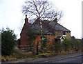

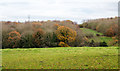
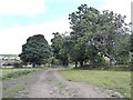
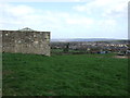
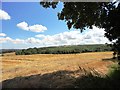
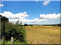
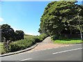
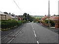
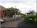
11 photos from this area
Area Information
Key information about the NE16 5XU including its size, population, and administrative classification.
- Area Type
- Postcode
- Area Size
- 9821 m²
- Population
- 1352
- Population Density
- 5514 people/km²
House Prices in NE16 5XU
22
Properties
£84,107
Average Sold Price
£42,000
Lowest Price
£125,000
Highest Price
Showing 22 properties
| Address | Type | Beds | Baths | Last Sale Price | Last Sale Date | |
|---|---|---|---|---|---|---|
| 16 Frosterley Walk, Sunniside, Whickham, NE16 5XU | Terraced | 3 | 1 | £125,000 | Oct 2021 | |
| 28 Frosterley Walk, Sunniside, Whickham, NE16 5XU | house | 3 | 1 | £120,000 | Feb 2019 | |
| 6 Frosterley Walk, Sunniside, Whickham, NE16 5XU | house | - | - | £119,000 | Apr 2010 | |
| 38 Frosterley Walk, Sunniside, Whickham, NE16 5XU | Terraced | - | - | £112,000 | Jun 2006 | |
| 26 Frosterley Walk, Sunniside, Whickham, NE16 5XU | Terraced | 3 | - | £123,500 | Dec 2004 | |
| 2 Frosterley Walk, Sunniside, Whickham, NE16 5XU | Terraced | 3 | 1 | £125,000 | Oct 2004 | |
| 40 Frosterley Walk, Sunniside, Whickham, NE16 5XU | Terraced | 3 | - | £98,000 | Dec 2003 | |
| 20 Frosterley Walk, Sunniside, Whickham, NE16 5XU | Terraced | - | - | £88,000 | Jul 2003 | |
| 34 Frosterley Walk, Sunniside, Whickham, NE16 5XU | Terraced | 3 | - | £49,500 | May 2001 | |
| 4 Frosterley Walk, Sunniside, Whickham, NE16 5XU | Terraced | - | - | £46,500 | Aug 1999 |
Page 1 of 3
Energy Efficiency in NE16 5XU
Amenities
Schools
| Rank | School | Type | Entry gender | Ages |
|---|
Explore more schools in this area
Go to Schools tabDemographics
Household Size
Two person
most common
Accommodation Type
Houses
most common
Tenure
60
majority
Ethnic Group
White
most common
Religion
N/A
most common
Household Composition
N/A
most common
Age
47
median
Adults (30-64 years)
most common
Household Deprivation
N/A
with no deprivation
NS-SEC
25
in Lower managerial occupations
Explore more demographic insights in this area
Go to Demographics tabPlanning
Planning Constraints
- Flood RiskPremium
- Ramsar Wetland SitesPremium
- Area of Outstanding Natural BeautyPremium
- Protected Nature ReservePremium
- Protected WoodlandPremium