Area Overview for NE16 5RU
Photos of NE16 5RU
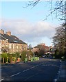
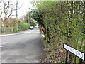
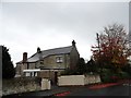
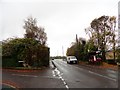
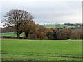
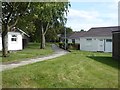
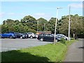
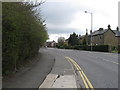


14 photos from this area
Area Information
Key information about the NE16 5RU including its size, population, and administrative classification.
- Area Type
- Postcode
- Area Size
- 5626 m²
- Population
- 1278
- Population Density
- 227151 people/km²
House Prices in NE16 5RU
15
Properties
£140,586
Average Sold Price
£1,500
Lowest Price
£195,000
Highest Price
Showing 15 properties
| Address | Type | Beds | Baths | Last Sale Price | Last Sale Date | |
|---|---|---|---|---|---|---|
| 1 Northcote, Whickham Central, Whickham, NE16 5RU | Bungalow | - | - | £195,000 | Mar 2024 | |
| 14 Northcote, Whickham Central, Whickham, NE16 5RU | Semi-detached | 2 | - | £1,500 | Feb 2022 | |
| 16 Northcote, Whickham Central, Whickham, NE16 5RU | Bungalow | 2 | - | £175,000 | Nov 2019 | |
| 13 Northcote, Whickham Central, Whickham, NE16 5RU | Bungalow | - | - | £178,000 | Aug 2017 | |
| 12 Northcote, Whickham Central, Whickham, NE16 5RU | Bungalow | 2 | - | £158,000 | Jun 2012 | |
| 3 Northcote, Whickham Central, Whickham, NE16 5RU | Terraced | - | - | £183,000 | Mar 2007 | |
| 2 Northcote, Whickham Central, Whickham, NE16 5RU | Bungalow | 2 | 1 | £185,000 | Jan 2007 | |
| 5 Northcote, Whickham Central, Whickham, NE16 5RU | Terraced | - | - | £183,000 | Nov 2005 | |
| 11 Northcote, Whickham Central, Whickham, NE16 5RU | Terraced | - | - | £150,000 | Aug 2003 | |
| 7 Northcote, Whickham Central, Whickham, NE16 5RU | Terraced | - | - | £78,000 | Oct 1999 |
Page 1 of 2
Energy Efficiency in NE16 5RU
Amenities
Schools
| Rank | School | Type | Entry gender | Ages |
|---|
Explore more schools in this area
Go to Schools tabDemographics
Household Size
Two person
most common
Accommodation Type
Houses
most common
Tenure
93
majority
Ethnic Group
White
most common
Religion
N/A
most common
Household Composition
N/A
most common
Age
47
median
Elderly (65+ years)
most common
Household Deprivation
N/A
with no deprivation
NS-SEC
40
in Lower managerial occupations
Explore more demographic insights in this area
Go to Demographics tabPlanning
Planning Constraints
- Flood RiskPremium
- Ramsar Wetland SitesPremium
- Area of Outstanding Natural BeautyPremium
- Protected Nature ReservePremium
- Protected WoodlandPremium