Area Overview for NE16 5PS
Photos of NE16 5PS
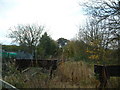
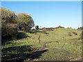
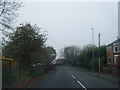
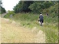
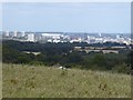
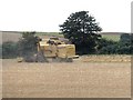
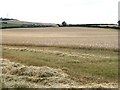
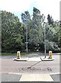
40 photos from this area
Area Information
Key information about the NE16 5PS including its size, population, and administrative classification.
- Area Type
- Postcode
- Area Size
- 6491 m²
- Population
- 1352
- Population Density
- 208292 people/km²
House Prices in NE16 5PS
21
Properties
£112,145
Average Sold Price
£46,950
Lowest Price
£147,500
Highest Price
Showing 21 properties
| Address | Type | Beds | Baths | Last Sale Price | Last Sale Date | |
|---|---|---|---|---|---|---|
| 20 Clover Hill, Sunniside, Whickham, NE16 5PS | Terraced | 2 | 1 | £126,000 | Oct 2025 | |
| 40 Clover Hill, Sunniside, Whickham, NE16 5PS | Semi-detached | 3 | 1 | £147,500 | Jun 2023 | |
| 56 Clover Hill, Sunniside, Whickham, NE16 5PS | house | - | - | £127,000 | Apr 2023 | |
| 22 Clover Hill, Sunniside, Whickham, NE16 5PS | house | 2 | - | £122,000 | Nov 2021 | |
| 26 Clover Hill, Sunniside, Whickham, NE16 5PS | Terraced | 3 | 1 | £115,000 | Mar 2017 | |
| 32 Clover Hill, Sunniside, Whickham, NE16 5PS | Terraced | - | - | £90,000 | May 2012 | |
| 38 Clover Hill, Sunniside, Whickham, NE16 5PS | house | 3 | - | £120,000 | Aug 2011 | |
| 50 Clover Hill, Sunniside, Whickham, NE16 5PS | Terraced | 3 | - | £112,000 | Mar 2008 | |
| 48 Clover Hill, Sunniside, Whickham, NE16 5PS | Terraced | 3 | - | £115,000 | Jan 2006 | |
| 34 Clover Hill, Sunniside, Whickham, NE16 5PS | Terraced | - | - | £46,950 | Mar 2002 |
Page 1 of 3
Energy Efficiency in NE16 5PS
Amenities
Schools
| Rank | School | Type | Entry gender | Ages |
|---|
Explore more schools in this area
Go to Schools tabDemographics
Household Size
Two person
most common
Accommodation Type
Houses
most common
Tenure
60
majority
Ethnic Group
White
most common
Religion
N/A
most common
Household Composition
N/A
most common
Age
47
median
Adults (30-64 years)
most common
Household Deprivation
N/A
with no deprivation
NS-SEC
25
in Lower managerial occupations
Explore more demographic insights in this area
Go to Demographics tabPlanning
Planning Constraints
- Flood RiskPremium
- Ramsar Wetland SitesPremium
- Area of Outstanding Natural BeautyPremium
- Protected Nature ReservePremium
- Protected WoodlandPremium