Area Overview for NE16 4RQ
Photos of NE16 4RQ
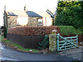
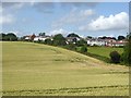
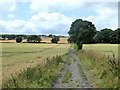
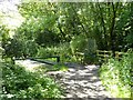
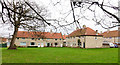
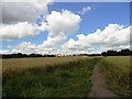
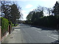
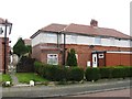
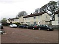
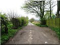
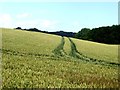
18 photos from this area
Area Information
Key information about the NE16 4RQ including its size, population, and administrative classification.
- Area Type
- Postcode
- Area Size
- 4082 m²
- Population
- 1388
- Population Density
- 835 people/km²
House Prices in NE16 4RQ
15
Properties
£102,611
Average Sold Price
£47,000
Lowest Price
£180,000
Highest Price
Showing 15 properties
| Address | Type | Beds | Baths | Last Sale Price | Last Sale Date | |
|---|---|---|---|---|---|---|
| 15 Broom Green, Whickham Central, Whickham, NE16 4RQ | Terraced | 3 | 1 | £180,000 | Aug 2024 | |
| 6 Broom Green, Whickham Central, Whickham, NE16 4RQ | house | - | - | £125,000 | Dec 2021 | |
| 5 Broom Green, Whickham Central, Whickham, NE16 4RQ | Terraced | 3 | 1 | £98,000 | Oct 2017 | |
| 14 Broom Green, Whickham Central, Whickham, NE16 4RQ | house | - | - | £120,000 | Dec 2016 | |
| 11 Broom Green, Whickham Central, Whickham, NE16 4RQ | house | - | - | £110,000 | Sep 2014 | |
| 13 Broom Green, Whickham Central, Whickham, NE16 4RQ | Terraced | 3 | - | £116,000 | Jul 2014 | |
| 3 Broom Green, Whickham Central, Whickham, NE16 4RQ | Terraced | - | - | £78,000 | Oct 2002 | |
| 10 Broom Green, Whickham Central, Whickham, NE16 4RQ | Semi-detached | 3 | 1 | £47,000 | Jul 1997 | |
| 8 Broom Green, Whickham Central, Whickham, NE16 4RQ | Terraced | - | - | £49,500 | Jul 1995 | |
| 1 Broom Green, Whickham Central, Whickham, NE16 4RQ | Terraced | 3 | - | - | - |
Page 1 of 2
Energy Efficiency in NE16 4RQ
Amenities
Schools
| Rank | School | Type | Entry gender | Ages |
|---|
Explore more schools in this area
Go to Schools tabDemographics
Household Size
Two person
most common
Accommodation Type
Houses
most common
Tenure
77
majority
Ethnic Group
White
most common
Religion
N/A
most common
Household Composition
N/A
most common
Age
47
median
Adults (30-64 years)
most common
Household Deprivation
N/A
with no deprivation
NS-SEC
36
in Lower managerial occupations
Explore more demographic insights in this area
Go to Demographics tabPlanning
Planning Constraints
- Flood RiskPremium
- Ramsar Wetland SitesPremium
- Area of Outstanding Natural BeautyPremium
- Protected Nature ReservePremium
- Protected WoodlandPremium