Area Overview for NE16 3EQ
Photos of NE16 3EQ
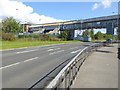
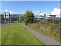
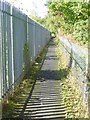
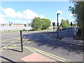

52 photos from this area
Area Information
Key information about the NE16 3EQ including its size, population, and administrative classification.
- Area Type
- Postcode
- Area Size
- 22.0 hectares
- Population
- 1569
- Population Density
- 860 people/km²
House Prices in NE16 3EQ
8
Properties
£194,500
Average Sold Price
£131,000
Lowest Price
£310,000
Highest Price
Showing 8 properties
| Address | Type | Beds | Baths | Last Sale Price | Last Sale Date | |
|---|---|---|---|---|---|---|
| Rydal, Market Lane, Swalwell, Whickham, NE16 3EQ | Semi-detached | 3 | 1 | £142,500 | Apr 2019 | |
| Danescroft, Market Lane, Swalwell, Whickham, NE16 3EQ | Semi-detached | 3 | - | £131,000 | Jun 2013 | |
| Glenbrae, 306 Market Lane, Swalwell, Whickham, NE16 3EQ | Semi-detached | - | - | £310,000 | Nov 2007 | |
| Selwyn, 300 Market Lane, Swalwell, Whickham, NE16 3EQ | Semi-detached | 3 | 2 | - | - | |
| Penshurst, 304 Market Lane, Swalwell, Whickham, NE16 3EQ | house | - | - | - | - | |
| Andoholme, Market Lane, Swalwell, Whickham, NE16 3EQ | Detached | - | - | - | - | |
| Wyncote, 302 Market Lane, Swalwell, Whickham, NE16 3EQ | Semi-detached | - | - | - | - | |
| Holmlea, Market Lane, Swalwell, Whickham, NE16 3EQ | house | - | - | - | - |
Energy Efficiency in NE16 3EQ
Amenities
Schools
| Rank | School | Type | Entry gender | Ages |
|---|
Explore more schools in this area
Go to Schools tabDemographics
Household Size
One person
most common
Accommodation Type
Houses
most common
Tenure
49
majority
Ethnic Group
White
most common
Religion
N/A
most common
Household Composition
N/A
most common
Age
47
median
Adults (30-64 years)
most common
Household Deprivation
N/A
with no deprivation
NS-SEC
25
in Lower managerial occupations
Explore more demographic insights in this area
Go to Demographics tabPlanning
Planning Constraints
- Flood RiskPremium
- Ramsar Wetland SitesPremium
- Area of Outstanding Natural BeautyPremium
- Protected Nature ReservePremium
- Protected WoodlandPremium