Area Overview for NE16 3EA
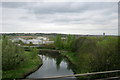
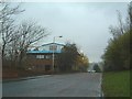
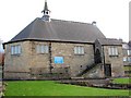
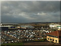
Photos of NE16 3EA


Area Information
Living in NE16 3EA offers a compact, residential experience shaped by its small cluster of homes and proximity to key amenities. With a population of 1,569 spread across 860 people per square kilometre, this area balances density with a sense of community. The demographic profile suggests a mature population, with a median age of 47 and a majority of residents aged 30–64. This makes NE16 3EA a place where many are settled in long-term homes, often in family-sized properties. Daily life here is convenience-focused, with nearby retail hubs like Lidl Whickham, Asda Gateshead, and Tesco Whickham within practical reach. Transport links are robust, with multiple railway stations and metro stops nearby, including Metrocentre Railway Station and Blaydon Railway Station. The area’s broadband connectivity is excellent, scoring 95, while mobile coverage is good at 85. These factors make it appealing for those working remotely or needing reliable digital access. However, the small size of NE16 3EA means buyers should consider adjacent areas for more housing options. Despite its compact nature, the area is well-integrated into regional networks, offering a blend of local convenience and broader connectivity.
- Area Type
- Postcode
- Area Size
- Not available
- Population
- 1569
- Population Density
- 860 people/km²
The property market in NE16 3EA is defined by its focus on houses, with 49% of residents owning their homes. This suggests a mix of owner-occupied and rental properties, though the small size of the area means the housing stock is limited. The predominance of houses indicates a preference for single-family living, which may appeal to families or those seeking more space. However, the 49% home ownership rate also implies that nearly half the properties are rented, potentially offering opportunities for buyers looking to enter the market. Given the area’s compact nature, buyers may need to look beyond NE16 3EA’s immediate boundaries for additional options. The presence of nearby railway stations, such as Metrocentre and Blaydon, could enhance the area’s appeal for commuters. For those prioritising property investment, the mix of ownership and rental properties may provide a stable market, though the small scale of the area means competition for available homes could be fierce.
House Prices in NE16 3EA
No properties found in this postcode.
Energy Efficiency in NE16 3EA
Residents of NE16 3EA have access to a range of amenities within practical reach, including retail outlets like Lidl Whickham, Asda Gateshead, and Tesco Whickham, which cater to daily shopping needs. The area’s transport links, such as Metrocentre Railway Station and Blaydon Railway Station, provide easy access to broader networks, while the nearby Newcastle Airport adds to regional connectivity. For leisure, the presence of metro stops like St James and Monument suggests proximity to urban centres with cultural or recreational facilities. The limited bus options, such as the Rhodes Street stop, may require supplementary transport for some trips. Overall, the combination of local retail, efficient rail links, and regional accessibility creates a lifestyle that balances convenience with the ability to explore beyond the immediate area. This makes NE16 3EA suitable for those who value both local amenities and the flexibility to travel further afield.
Amenities
Schools
| Rank | School | Type | Entry gender | Ages |
|---|
Explore more schools in this area
Go to Schools tabDemographics
The community in NE16 3EA is predominantly composed of adults aged 30–64, reflecting a median age of 47. This suggests a population that is largely established, with fewer young families or retirees compared to other areas. Home ownership rates here are 49%, indicating a mix of owner-occupied and rented properties. The accommodation type is primarily houses, which aligns with the area’s residential character. The predominant ethnic group is White, though specific data on diversity is not provided. The population density of 860 people per square kilometre implies a moderately compact living environment, where proximity to amenities is a key feature. For buyers, this demographic profile suggests a stable, mature community with a focus on long-term residency. The lower proportion of renters may reflect a preference for property investment in this area, though the 49% ownership rate also highlights the presence of rental housing. This balance could be important for those considering whether to buy or rent in NE16 3EA.
Household Size
Accommodation Type
Tenure
Ethnic Group
Religion
Household Composition
Age
Household Deprivation
NS-SEC
Explore more demographic insights in this area
Go to Demographics tabPlanning
Planning Constraints
- Flood RiskPremium
- Ramsar Wetland SitesPremium
- Area of Outstanding Natural BeautyPremium
- Protected Nature ReservePremium
- Protected WoodlandPremium