Area Overview for NE15 9LE
Photos of NE15 9LE
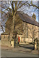
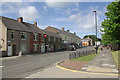


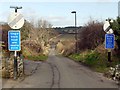
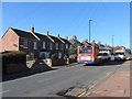
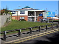
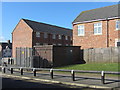
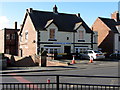
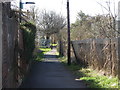
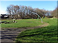
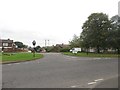
90 photos from this area
Area Information
Key information about the NE15 9LE including its size, population, and administrative classification.
- Area Type
- Postcode
- Area Size
- 1.2 hectares
- Population
- 1583
- Population Density
- 1640 people/km²
House Prices in NE15 9LE
31
Properties
£167,432
Average Sold Price
£44,999
Lowest Price
£430,000
Highest Price
Showing 31 properties
| Address | Type | Beds | Baths | Last Sale Price | Last Sale Date | |
|---|---|---|---|---|---|---|
| 7 Woodlands, Throckley, Newcastle Upon Tyne, NE15 9LE | Semi-detached | 3 | 1 | £202,000 | Oct 2025 | |
| 11 Woodlands, Throckley, Newcastle Upon Tyne, NE15 9LE | Semi-detached | 3 | 1 | £187,500 | Aug 2025 | |
| 25 Woodlands, Throckley, Newcastle Upon Tyne, NE15 9LE | Semi-detached | 3 | 1 | £190,000 | Mar 2025 | |
| 17 Woodlands, Throckley, Newcastle Upon Tyne, NE15 9LE | Semi-detached | 3 | 1 | £176,840 | Jul 2023 | |
| 1 Woodlands, Throckley, Newcastle Upon Tyne, NE15 9LE | Detached | 4 | 2 | £205,000 | Sep 2022 | |
| 2A Woodlands, Throckley, Newcastle Upon Tyne, NE15 9LE | Flat | - | - | £430,000 | Jul 2022 | |
| 20 Woodlands, Throckley, Newcastle Upon Tyne, NE15 9LE | Bungalow | 1 | 1 | £148,000 | Apr 2019 | |
| 24 Woodlands, Throckley, Newcastle Upon Tyne, NE15 9LE | Detached | 3 | 2 | £135,000 | Jul 2017 | |
| 26 Woodlands, Throckley, Newcastle Upon Tyne, NE15 9LE | Semi-detached | 2 | - | £140,000 | Feb 2016 | |
| 5 Woodlands, Throckley, Newcastle Upon Tyne, NE15 9LE | Semi-detached | 3 | 1 | £135,000 | Jul 2015 |
Page 1 of 4
Energy Efficiency in NE15 9LE
Amenities
Schools
| Rank | School | Type | Entry gender | Ages |
|---|
Explore more schools in this area
Go to Schools tabDemographics
Household Size
Two person
most common
Accommodation Type
Houses
most common
Tenure
81
majority
Ethnic Group
White
most common
Religion
N/A
most common
Household Composition
N/A
most common
Age
47
median
Adults (30-64 years)
most common
Household Deprivation
N/A
with no deprivation
NS-SEC
34
in Lower managerial occupations
Explore more demographic insights in this area
Go to Demographics tabPlanning
Planning Constraints
- Flood RiskPremium
- Ramsar Wetland SitesPremium
- Area of Outstanding Natural BeautyPremium
- Protected Nature ReservePremium
- Protected WoodlandPremium