Area Overview for NE15 8XG
Photos of NE15 8XG
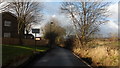
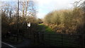
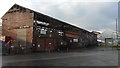
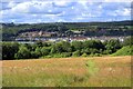

50 photos from this area
Area Information
Key information about the NE15 8XG including its size, population, and administrative classification.
- Area Type
- Postcode
- Area Size
- 3355 m²
- Population
- 1551
- Population Density
- 2427 people/km²
House Prices in NE15 8XG
8
Properties
£114,742
Average Sold Price
£92,500
Lowest Price
£139,950
Highest Price
Showing 8 properties
| Address | Type | Beds | Baths | Last Sale Price | Last Sale Date | |
|---|---|---|---|---|---|---|
| 46 Burnham Avenue, Lemington, Newcastle Upon Tyne, NE15 8XG | Semi-detached | 2 | 1 | £92,500 | Oct 2022 | |
| 56 Burnham Avenue, Lemington, Newcastle Upon Tyne, NE15 8XG | Semi-detached | 2 | 1 | £139,950 | Jun 2022 | |
| 52 Burnham Avenue, Lemington, Newcastle Upon Tyne, NE15 8XG | Semi-detached | 2 | 1 | £110,000 | Dec 2015 | |
| 48 Burnham Avenue, Lemington, Newcastle Upon Tyne, NE15 8XG | Semi-detached | - | - | £135,000 | Feb 2015 | |
| 44 Burnham Avenue, Lemington, Newcastle Upon Tyne, NE15 8XG | Semi-detached | 2 | 1 | £110,000 | Mar 2005 | |
| 58 Burnham Avenue, Lemington, Newcastle Upon Tyne, NE15 8XG | Semi-detached | - | - | £101,000 | Apr 2004 | |
| 54 Burnham Avenue, Lemington, Newcastle Upon Tyne, NE15 8XG | Detached | 2 | - | - | - | |
| 50 Burnham Avenue, Lemington, Newcastle Upon Tyne, NE15 8XG | Semi-detached | 2 | 1 | - | - |
Energy Efficiency in NE15 8XG
Amenities
Schools
| Rank | School | Type | Entry gender | Ages |
|---|
Explore more schools in this area
Go to Schools tabDemographics
Household Size
One person
most common
Accommodation Type
Houses
most common
Tenure
48
majority
Ethnic Group
White
most common
Religion
N/A
most common
Household Composition
N/A
most common
Age
47
median
Adults (30-64 years)
most common
Household Deprivation
N/A
with no deprivation
NS-SEC
28
in Lower managerial occupations
Explore more demographic insights in this area
Go to Demographics tabPlanning
Planning Constraints
- Flood RiskPremium
- Ramsar Wetland SitesPremium
- Area of Outstanding Natural BeautyPremium
- Protected Nature ReservePremium
- Protected WoodlandPremium