Area Overview for NE15 8LU
Photos of NE15 8LU

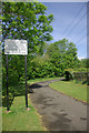
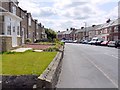
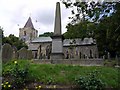


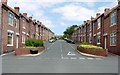

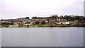
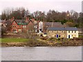
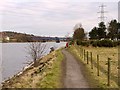
100 photos from this area
Area Information
Key information about the NE15 8LU including its size, population, and administrative classification.
- Area Type
- Postcode
- Area Size
- 1.2 hectares
- Population
- 1551
- Population Density
- 2427 people/km²
House Prices in NE15 8LU
61
Properties
£74,301
Average Sold Price
£25,000
Lowest Price
£128,000
Highest Price
Showing 61 properties
| Address | Type | Beds | Baths | Last Sale Price | Last Sale Date | |
|---|---|---|---|---|---|---|
| 14 Boyd Street, Newburn, Newcastle Upon Tyne, NE15 8LU | Terraced | 3 | 1 | £128,000 | Dec 2025 | |
| 17 Boyd Street, Newburn, Newcastle Upon Tyne, NE15 8LU | Terraced | 2 | 1 | £103,000 | Aug 2025 | |
| 39 Boyd Street, Newburn, Newcastle Upon Tyne, NE15 8LU | Terraced | 2 | 1 | £60,000 | Mar 2024 | |
| 37 Boyd Street, Newburn, Newcastle Upon Tyne, NE15 8LU | Terraced | 2 | 1 | £65,000 | Feb 2024 | |
| 57 Boyd Street, Newburn, Newcastle Upon Tyne, NE15 8LU | Terraced | 2 | 1 | £96,250 | Feb 2023 | |
| 46 Boyd Street, Newburn, Newcastle Upon Tyne, NE15 8LU | house | - | - | £73,500 | Jun 2022 | |
| 18 Boyd Street, Newburn, Newcastle Upon Tyne, NE15 8LU | house | - | - | £92,000 | Sep 2021 | |
| 35 Boyd Street, Newburn, Newcastle Upon Tyne, NE15 8LU | house | - | - | £110,000 | Sep 2021 | |
| 23 Boyd Street, Newburn, Newcastle Upon Tyne, NE15 8LU | house | - | - | £94,000 | Aug 2021 | |
| 61 Boyd Street, Newburn, Newcastle Upon Tyne, NE15 8LU | house | - | - | £96,000 | May 2021 |
Page 1 of 7
Energy Efficiency in NE15 8LU
Amenities
Schools
| Rank | School | Type | Entry gender | Ages |
|---|
Explore more schools in this area
Go to Schools tabDemographics
Household Size
One person
most common
Accommodation Type
Houses
most common
Tenure
48
majority
Ethnic Group
White
most common
Religion
N/A
most common
Household Composition
N/A
most common
Age
47
median
Adults (30-64 years)
most common
Household Deprivation
N/A
with no deprivation
NS-SEC
28
in Lower managerial occupations
Explore more demographic insights in this area
Go to Demographics tabPlanning
Planning Constraints
- Flood RiskPremium
- Ramsar Wetland SitesPremium
- Area of Outstanding Natural BeautyPremium
- Protected Nature ReservePremium
- Protected WoodlandPremium