Area Overview for NE15 8BA
Photos of NE15 8BA

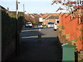
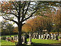
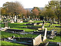
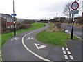
18 photos from this area
Area Information
Key information about the NE15 8BA including its size, population, and administrative classification.
- Area Type
- Postcode
- Area Size
- 7737 m²
- Population
- 1260
- Population Density
- 162849 people/km²
House Prices in NE15 8BA
18
Properties
£108,750
Average Sold Price
£86,000
Lowest Price
£122,500
Highest Price
Showing 18 properties
| Address | Type | Beds | Baths | Last Sale Price | Last Sale Date | |
|---|---|---|---|---|---|---|
| 100 Union Hall Road, Lemington, Newcastle Upon Tyne, NE15 8BA | Semi-detached | 3 | 1 | £122,500 | Nov 2020 | |
| 76 Union Hall Road, Lemington, Newcastle Upon Tyne, NE15 8BA | Semi-detached | 3 | 1 | £113,000 | Oct 2018 | |
| 88 Union Hall Road, Lemington, Newcastle Upon Tyne, NE15 8BA | Semi-detached | 3 | 1 | £86,000 | Jan 2018 | |
| 80 Union Hall Road, Lemington, Newcastle Upon Tyne, NE15 8BA | Semi-detached | - | - | £113,500 | Jan 2007 | |
| 84 Union Hall Road, Lemington, Newcastle Upon Tyne, NE15 8BA | Detached | 3 | 1 | - | - | |
| 94 Union Hall Road, Lemington, Newcastle Upon Tyne, NE15 8BA | house | - | - | - | - | |
| 106 Union Hall Road, Lemington, Newcastle Upon Tyne, NE15 8BA | Semi-detached | - | - | - | - | |
| 96 Union Hall Road, Lemington, Newcastle Upon Tyne, NE15 8BA | Detached | - | - | - | - | |
| 78 Union Hall Road, Lemington, Newcastle Upon Tyne, NE15 8BA | Semi-detached | - | - | - | - | |
| 74 Union Hall Road, Lemington, Newcastle Upon Tyne, NE15 8BA | Semi-detached | - | - | - | - |
Page 1 of 2
Energy Efficiency in NE15 8BA
Amenities
Schools
| Rank | School | Type | Entry gender | Ages |
|---|
Explore more schools in this area
Go to Schools tabDemographics
Household Size
N/A
most common
Accommodation Type
N/A
most common
Tenure
N/A
majority
Ethnic Group
N/A
most common
Religion
N/A
most common
Household Composition
N/A
most common
Age
N/A
median
N/A
most common
Household Deprivation
N/A
with no deprivation
NS-SEC
N/A
in Lower managerial occupations
Explore more demographic insights in this area
Go to Demographics tabPlanning
Planning Constraints
- Flood RiskPremium
- Ramsar Wetland SitesPremium
- Area of Outstanding Natural BeautyPremium
- Protected Nature ReservePremium
- Protected WoodlandPremium