Area Overview for NE15 7PS
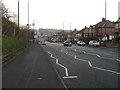
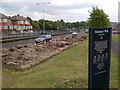
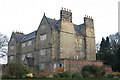
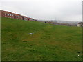
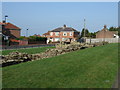
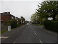
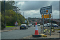
Photos of NE15 7PS


Area Information
NE15 7PS is a small residential postcode area in England, home to around 1722 people. It is a compact cluster of properties, primarily occupied by homeowners, with a median age of 47. The area appeals to adults aged 30–64, reflecting a mature, stable community. Daily life here is shaped by proximity to essential services, including multiple rail and metro stations, which provide easy access to nearby towns and cities. The area’s modest size means it is tightly knit, with residents likely to know their neighbours. While it lacks the density of larger urban centres, its location offers a balance between suburban comfort and connectivity. The absence of major environmental constraints, such as protected woodlands or Areas of Outstanding Natural Beauty, ensures development is not restricted. However, the area’s character is defined by its practicality, with homes predominantly in the private sector and a focus on local amenities. For those seeking a quiet, family-friendly environment with reliable transport links, NE15 7PS offers a straightforward, no-frills living experience.
- Area Type
- Postcode
- Area Size
- Not available
- Population
- 1722
- Population Density
- 5818 people/km²
NE15 7PS is a predominantly owner-occupied area, with 80% of homes owned by their occupants. The housing stock consists mainly of houses, which contrasts with areas where flats or apartments predominate. This suggests a market focused on family homes rather than rental properties, potentially limiting availability for buyers seeking short-term tenancies. The small size of the postcode area means the housing stock is limited, and properties are likely to be in close proximity to each other. For buyers, this implies a need to consider the immediate surroundings for additional options. The high home ownership rate also indicates a stable market, with fewer fluctuations in property values. However, the lack of data on property prices or recent sales trends means potential buyers should conduct local research. The presence of multiple rail and metro stations may also influence property desirability, offering commuters easy access to larger urban centres.
House Prices in NE15 7PS
No properties found in this postcode.
Energy Efficiency in NE15 7PS
The lifestyle in NE15 7PS is shaped by its access to retail, transport, and leisure facilities. Nearby shops include Sainsburys Denton Burn, Iceland Newcastle, and Lidl Fenham, providing everyday essentials within reach. The area’s rail and metro stations—such as Blaydon, Metrocentre, and Dunston—offer frequent connections to Newcastle and beyond, while the nearby Newcastle Airport ensures easy travel for those needing regional or international flights. The presence of multiple transport hubs supports a dynamic lifestyle, with options for shopping, dining, and leisure activities in nearby towns. Although the data does not specify parks or recreational spaces, the proximity to transport links implies access to broader amenities. The combination of retail options and transport infrastructure makes daily life convenient, with minimal need for long commutes. For residents, this balance of practicality and connectivity defines the area’s appeal.
Amenities
Schools
Residents of NE15 7PS have access to two primary schools within practical reach. St Bede’s RC Primary School and St Bede’s Catholic Primary School, Newcastle, both cater to younger children. The latter holds an Ofsted rating of ‘good’, indicating a satisfactory standard of education. The availability of two primary schools within the area provides families with options, though no secondary schools are listed in the data. The presence of two schools with similar names suggests a potential for consistency in educational quality, though further details on curriculum or facilities are not provided. For families prioritising primary education, the proximity of these schools reduces commuting time and supports a community-focused lifestyle. The absence of secondary school options may require families to look slightly beyond the postcode area for comprehensive education.
| Rank | School | Type | Entry gender | Ages |
|---|
Explore more schools in this area
Go to Schools tabDemographics
The population of NE15 7PS is 1722, with a median age of 47. The majority of residents fall within the 30–64 age range, indicating a community skewed towards middle-aged adults. Home ownership is high, with 80% of properties occupied by their owners, suggesting a stable, long-term resident base. The area is characterised by houses rather than flats, reflecting a preference for single-family dwellings. The predominant ethnic group is White, though no further breakdown of diversity is provided. The age profile implies a mature demographic, likely with established careers and families. The absence of specific data on deprivation or income levels means the quality of life can only be inferred from the availability of amenities and services. With no significant environmental constraints, residents benefit from a straightforward living environment, though the community’s character remains defined by its age group and housing type.
Household Size
Accommodation Type
Tenure
Ethnic Group
Religion
Household Composition
Age
Household Deprivation
NS-SEC
Explore more demographic insights in this area
Go to Demographics tabPlanning
Planning Constraints
- Flood RiskPremium
- Ramsar Wetland SitesPremium
- Area of Outstanding Natural BeautyPremium
- Protected Nature ReservePremium
- Protected WoodlandPremium