Area Overview for NE15 7AA
Photos of NE15 7AA

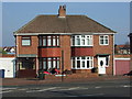
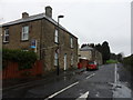
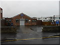
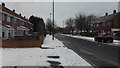
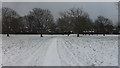
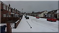

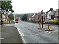
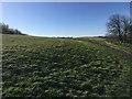
57 photos from this area
Area Information
Key information about the NE15 7AA including its size, population, and administrative classification.
- Area Type
- Postcode
- Area Size
- 1.4 hectares
- Population
- 1287
- Population Density
- 91366 people/km²
House Prices in NE15 7AA
21
Properties
£195,113
Average Sold Price
£48,200
Lowest Price
£307,000
Highest Price
Showing 21 properties
| Address | Type | Beds | Baths | Last Sale Price | Last Sale Date | |
|---|---|---|---|---|---|---|
| 11 Brignall Gardens, Benwell, Newcastle Upon Tyne, NE15 7AA | Semi-detached | 3 | - | £180,000 | Feb 2025 | |
| 16 Brignall Gardens, Benwell, Newcastle Upon Tyne, NE15 7AA | Detached | 5 | 3 | £300,000 | Apr 2024 | |
| 4A Brignall Gardens, Benwell, Newcastle Upon Tyne, NE15 7AA | Detached | 3 | 1 | £307,000 | Aug 2023 | |
| 6 Brignall Gardens, Benwell, Newcastle Upon Tyne, NE15 7AA | Semi-detached | 3 | 2 | £285,000 | Apr 2023 | |
| 19 Brignall Gardens, Benwell, Newcastle Upon Tyne, NE15 7AA | Semi-detached | 3 | 1 | £176,500 | Nov 2019 | |
| 9 Brignall Gardens, Benwell, Newcastle Upon Tyne, NE15 7AA | Semi-detached | 3 | - | £225,000 | Oct 2019 | |
| 2 Brignall Gardens, Benwell, Newcastle Upon Tyne, NE15 7AA | Bungalow | 4 | 1 | £260,000 | Oct 2016 | |
| 1 Brignall Gardens, Benwell, Newcastle Upon Tyne, NE15 7AA | Semi-detached | 3 | - | £154,000 | Sep 2016 | |
| 13 Brignall Gardens, Benwell, Newcastle Upon Tyne, NE15 7AA | house | - | - | £165,000 | Aug 2015 | |
| 15 Brignall Gardens, Benwell, Newcastle Upon Tyne, NE15 7AA | house | - | - | £140,000 | Apr 2012 |
Page 1 of 3
Energy Efficiency in NE15 7AA
Amenities
Schools
| Rank | School | Type | Entry gender | Ages |
|---|
Explore more schools in this area
Go to Schools tabDemographics
Household Size
Two person
most common
Accommodation Type
Houses
most common
Tenure
86
majority
Ethnic Group
White
most common
Religion
N/A
most common
Household Composition
N/A
most common
Age
47
median
Adults (30-64 years)
most common
Household Deprivation
N/A
with no deprivation
NS-SEC
31
in Lower managerial occupations
Explore more demographic insights in this area
Go to Demographics tabPlanning
Planning Constraints
- Flood RiskPremium
- Ramsar Wetland SitesPremium
- Area of Outstanding Natural BeautyPremium
- Protected Nature ReservePremium
- Protected WoodlandPremium