Area Overview for NE15 6JE
Photos of NE15 6JE

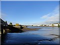
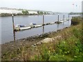
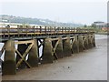

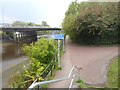
63 photos from this area
Area Information
Key information about the NE15 6JE including its size, population, and administrative classification.
- Area Type
- Postcode
- Area Size
- 7290 m²
- Population
- 1694
- Population Density
- 232384 people/km²
House Prices in NE15 6JE
49
Properties
£143,915
Average Sold Price
£22,000
Lowest Price
£210,000
Highest Price
Showing 49 properties
| Address | Type | Beds | Baths | Last Sale Price | Last Sale Date | |
|---|---|---|---|---|---|---|
| 241 Armstrong Road, Benwell, Newcastle Upon Tyne, NE15 6JE | Flat | - | - | £125,000 | Dec 2023 | |
| 235 Armstrong Road, Benwell, Newcastle Upon Tyne, NE15 6JE | Semi-detached | 2 | 1 | £153,500 | Aug 2023 | |
| 211 Armstrong Road, Benwell, Newcastle Upon Tyne, NE15 6JE | house | - | - | £210,000 | Feb 2023 | |
| 223 Armstrong Road, Benwell, Newcastle Upon Tyne, NE15 6JE | Semi-detached | 2 | 2 | £149,000 | Sep 2022 | |
| 201 Armstrong Road, Benwell, Newcastle Upon Tyne, NE15 6JE | house | - | - | £185,850 | Jul 2022 | |
| 213 Armstrong Road, Benwell, Newcastle Upon Tyne, NE15 6JE | house | - | - | £200,000 | Feb 2022 | |
| 245 Armstrong Road, Benwell, Newcastle Upon Tyne, NE15 6JE | house | - | - | £163,000 | Dec 2021 | |
| 195 Armstrong Road, Benwell, Newcastle Upon Tyne, NE15 6JE | Flat | 2 | 1 | £85,000 | Jul 2021 | |
| 225 Armstrong Road, Benwell, Newcastle Upon Tyne, NE15 6JE | house | - | - | £127,000 | Feb 2021 | |
| 247 Armstrong Road, Benwell, Newcastle Upon Tyne, NE15 6JE | Detached | 3 | 1 | £180,000 | Jun 2020 |
Page 1 of 5
Energy Efficiency in NE15 6JE
Amenities
Schools
| Rank | School | Type | Entry gender | Ages |
|---|
Explore more schools in this area
Go to Schools tabDemographics
Household Size
Family (3-5 people)
most common
Accommodation Type
Houses
most common
Tenure
44
majority
Ethnic Group
White
most common
Religion
N/A
most common
Household Composition
N/A
most common
Age
47
median
Adults (30-64 years)
most common
Household Deprivation
N/A
with no deprivation
NS-SEC
22
in Lower managerial occupations
Explore more demographic insights in this area
Go to Demographics tabPlanning
Planning Constraints
- Flood RiskPremium
- Ramsar Wetland SitesPremium
- Area of Outstanding Natural BeautyPremium
- Protected Nature ReservePremium
- Protected WoodlandPremium