Area Overview for NE15 0DY
Photos of NE15 0DY


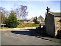
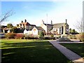
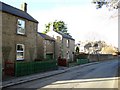

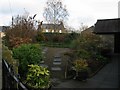
100 photos from this area
Area Information
Key information about the NE15 0DY including its size, population, and administrative classification.
- Area Type
- Postcode
- Area Size
- 9.0 hectares
- Population
- 1535
- Population Density
- 81 people/km²
House Prices in NE15 0DY
22
Properties
£290,993
Average Sold Price
£129,950
Lowest Price
£475,000
Highest Price
Showing 22 properties
| Address | Type | Beds | Baths | Last Sale Price | Last Sale Date | |
|---|---|---|---|---|---|---|
| 1 Station Road, Heddon On The Wall, NE15 0DY | Bungalow | 3 | 1 | £395,000 | Apr 2025 | |
| 14 Station Road, Heddon On The Wall, NE15 0DY | Bungalow | 3 | 1 | £475,000 | Dec 2024 | |
| 11 Station Road, Heddon On The Wall, NE15 0DY | Bungalow | 2 | 1 | £235,000 | Jan 2023 | |
| 6 Station Road, Heddon On The Wall, NE15 0DY | Bungalow | 3 | 2 | £345,000 | Apr 2021 | |
| 7 Station Road, Heddon On The Wall, NE15 0DY | Bungalow | 2 | - | £294,000 | Jun 2020 | |
| 15 Station Road, Heddon On The Wall, NE15 0DY | Semi-detached | 3 | 1 | £279,000 | Feb 2018 | |
| River Heights, 16 Station Road, Heddon On The Wall, NE15 0DY | Detached | - | - | £285,000 | Aug 2017 | |
| 9 Station Road, Heddon On The Wall, NE15 0DY | Bungalow | 3 | 1 | £150,000 | Dec 2013 | |
| 5 Station Road, Heddon On The Wall, NE15 0DY | Bungalow | 2 | - | £214,950 | Aug 2013 | |
| 4 Station Road, Heddon On The Wall, NE15 0DY | house | - | - | £228,000 | May 2011 |
Page 1 of 3
Energy Efficiency in NE15 0DY
Amenities
Schools
| Rank | School | Type | Entry gender | Ages |
|---|
Explore more schools in this area
Go to Schools tabDemographics
Household Size
Two person
most common
Accommodation Type
Houses
most common
Tenure
82
majority
Ethnic Group
White
most common
Religion
N/A
most common
Household Composition
N/A
most common
Age
47
median
Adults (30-64 years)
most common
Household Deprivation
N/A
with no deprivation
NS-SEC
44
in Lower managerial occupations
Explore more demographic insights in this area
Go to Demographics tabPlanning
Planning Constraints
- Flood RiskPremium
- Ramsar Wetland SitesPremium
- Area of Outstanding Natural BeautyPremium
- Protected Nature ReservePremium
- Protected WoodlandPremium