Area Overview for NE13 8BS
Photos of NE13 8BS

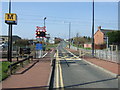


60 photos from this area
Area Information
Key information about the NE13 8BS including its size, population, and administrative classification.
- Area Type
- Postcode
- Area Size
- 29.5 hectares
- Population
- 2133
- Population Density
- 137 people/km²
House Prices in NE13 8BS
11
Properties
£561,833
Average Sold Price
£300,000
Lowest Price
£909,000
Highest Price
Showing 11 properties
| Address | Type | Beds | Baths | Last Sale Price | Last Sale Date | |
|---|---|---|---|---|---|---|
| Shenley, Middle Drive, Newcastle Upon Tyne, NE13 8BS | Bungalow | - | - | £500,000 | Jun 2021 | |
| Trees, Middle Drive, Newcastle Upon Tyne, NE13 8BS | Detached | - | - | £800,000 | Feb 2020 | |
| Braeside, Middle Drive, Newcastle Upon Tyne, NE13 8BS | house | - | - | £625,000 | Nov 2019 | |
| Ashlea, Middle Drive, Newcastle Upon Tyne, NE13 8BS | house | 4 | - | £909,000 | Aug 2018 | |
| Beecroft, Middle Drive, Newcastle Upon Tyne, NE13 8BS | Bungalow | 3 | 2 | £407,500 | Sep 2016 | |
| High Beeches, Middle Drive, Newcastle Upon Tyne, NE13 8BS | Detached | 4 | 3 | £300,000 | May 2016 | |
| Woodlynn, Middle Drive, Newcastle Upon Tyne, NE13 8BS | house | - | - | £625,000 | Nov 2010 | |
| Old Trees, Middle Drive, Newcastle Upon Tyne, NE13 8BS | Bungalow | 5 | 2 | £540,000 | Jul 2009 | |
| Pine Trees, Middle Drive, Newcastle Upon Tyne, NE13 8BS | house | - | - | £350,000 | Nov 2008 | |
| Oaklea, Middle Drive, Newcastle Upon Tyne, NE13 8BS | Detached | - | - | - | - |
Page 1 of 2
Energy Efficiency in NE13 8BS
Amenities
Schools
| Rank | School | Type | Entry gender | Ages |
|---|
Explore more schools in this area
Go to Schools tabDemographics
Household Size
Two person
most common
Accommodation Type
Houses
most common
Tenure
89
majority
Ethnic Group
White
most common
Religion
N/A
most common
Household Composition
N/A
most common
Age
47
median
Adults (30-64 years)
most common
Household Deprivation
N/A
with no deprivation
NS-SEC
46
in Lower managerial occupations
Explore more demographic insights in this area
Go to Demographics tabPlanning
Planning Constraints
- Flood RiskPremium
- Ramsar Wetland SitesPremium
- Area of Outstanding Natural BeautyPremium
- Protected Nature ReservePremium
- Protected WoodlandPremium