Area Overview for NE13 7YF
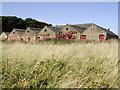
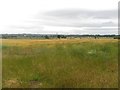
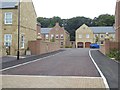
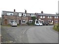
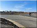
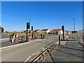
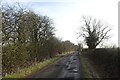
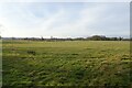
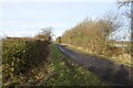
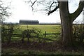
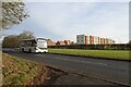
Photos of NE13 7YF

Area Information
Living in NE13 7YF offers a compact, residential experience shaped by its small cluster of homes and proximity to essential services. With a population of 1,761 people spread across a densely populated area at 894 people per square kilometre, this postcode reflects a tightly knit community. Daily life here is characterised by ease of access to nearby amenities, including retail hubs like Morrisons and Tesco, as well as rail and metro connections. The area’s demographic profile suggests a mature population, with the majority of residents aged 30–64, contributing to a stable, established neighbourhood. While the postcode itself is small, its integration with surrounding areas provides a balance between residential comfort and practical connectivity. The presence of Havannah First School, rated ‘good’ by Ofsted, adds to the appeal for families. For those prioritising safety, the area scores highly for low crime risk and flood risk, making it a viable option for those seeking a secure, well-served environment without the pressures of larger urban centres.
- Area Type
- Postcode
- Area Size
- Not available
- Population
- 1761
- Population Density
- 894 people/km²
The property market in NE13 7YF is dominated by owner-occupied homes, with 90% of residents living in their own properties. This high rate of home ownership suggests a stable, long-term market with limited rental activity, which can be advantageous for buyers seeking a secure investment. The accommodation type is primarily houses, indicating a preference for standalone properties over flats or apartments. This aligns with the area’s residential character and may appeal to those prioritising space and privacy. Given the small size of the postcode, the housing stock is likely limited, making it a niche market for buyers looking for specific properties. The absence of planning constraints or environmental restrictions further simplifies the process of purchasing or renovating homes. For those considering the area, the combination of high home ownership and house-centric stock suggests a community where property values are likely to hold their ground, supported by the area’s safety and connectivity.
House Prices in NE13 7YF
No properties found in this postcode.
Energy Efficiency in NE13 7YF
Residents of NE13 7YF have access to a range of amenities within practical reach. Retail options include major stores like Morrisons, Tesco, and M&S Kenton, providing everyday shopping convenience. The area’s metro and rail connections, such as Kingston Park and Fawdon stations, offer easy access to nearby towns and attractions. Newcastle Airport is also nearby, enhancing travel options for both leisure and business. For leisure, the proximity to rail stations and metro stops suggests opportunities for outdoor activities or cultural visits in surrounding areas. The presence of Havannah First School and the low crime risk further contribute to a family-friendly environment. While the data does not list specific parks or leisure facilities, the area’s connectivity implies access to broader regional amenities. Overall, the combination of retail, transport, and educational resources supports a balanced lifestyle with practical convenience.
Amenities
Schools
The nearest school to NE13 7YF is Havannah First School, a primary school rated ‘good’ by Ofsted. This provides a solid foundation for families with young children, though no secondary schools are listed in the data. The presence of a well-rated primary school enhances the area’s appeal for households prioritising education quality. The absence of secondary school options may require families to consider commuting to nearby areas, but the proximity to rail and metro stations, including Newcastle Airport Metro Station and Cramlington Railway Station, facilitates such travel. For parents, Havannah First School’s ‘good’ rating offers reassurance about the standard of early education, though further research would be needed to assess the full range of educational provisions in the surrounding region.
| Rank | School | Type | Entry gender | Ages |
|---|
Explore more schools in this area
Go to Schools tabDemographics
NE13 7YF is predominantly inhabited by adults aged 30–64, with a median age of 47. This suggests a mature, established community with a focus on long-term residency. Home ownership is exceptionally high at 90%, indicating a stable housing market where most residents live in their own homes rather than renting. The accommodation type is primarily houses, which aligns with the area’s residential character and contributes to a sense of privacy and space. The predominant ethnic group is White, reflecting a homogenous demographic profile. While no specific data on deprivation is provided, the high home ownership rate and low crime risk suggest a relatively affluent and secure environment. The absence of protected natural areas or planning constraints further implies a straightforward living experience without complex regulatory barriers. For prospective buyers, this demographic structure points to a community with low turnover and a focus on family-oriented stability.
Household Size
Accommodation Type
Tenure
Ethnic Group
Religion
Household Composition
Age
Household Deprivation
NS-SEC
Explore more demographic insights in this area
Go to Demographics tabPlanning
Planning Constraints
- Flood RiskPremium
- Ramsar Wetland SitesPremium
- Area of Outstanding Natural BeautyPremium
- Protected Nature ReservePremium
- Protected WoodlandPremium