Area Overview for NE13 7BH
Photos of NE13 7BH
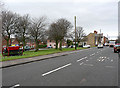
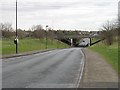
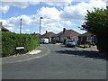
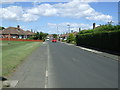
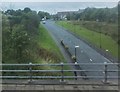
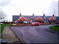

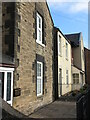
11 photos from this area
Area Information
Key information about the NE13 7BH including its size, population, and administrative classification.
- Area Type
- Postcode
- Area Size
- 4723 m²
- Population
- 1277
- Population Density
- 4870 people/km²
House Prices in NE13 7BH
16
Properties
£107,190
Average Sold Price
£44,950
Lowest Price
£130,000
Highest Price
Showing 16 properties
| Address | Type | Beds | Baths | Last Sale Price | Last Sale Date | |
|---|---|---|---|---|---|---|
| 5 Melock Court, Wideopen, NE13 7BH | Detached | 3 | 1 | £129,000 | May 2021 | |
| 11 Melock Court, Wideopen, NE13 7BH | house | 3 | - | £130,000 | Jun 2017 | |
| 21 Melock Court, Wideopen, NE13 7BH | Terraced | 3 | 1 | £122,000 | Jan 2014 | |
| 23 Melock Court, Wideopen, NE13 7BH | Terraced | - | - | £110,000 | Jul 2005 | |
| 19 Melock Court, Wideopen, NE13 7BH | Terraced | - | - | £44,950 | Mar 1998 | |
| 4 Melock Court, Wideopen, NE13 7BH | Semi-detached | 2 | 1 | - | - | |
| 2 Melock Court, Wideopen, NE13 7BH | Bungalow | 2 | - | - | - | |
| 3 Melock Court, Wideopen, NE13 7BH | house | - | - | - | - | |
| 27 Melock Court, Wideopen, NE13 7BH | Terraced | - | - | - | - | |
| 1 Melock Court, Wideopen, NE13 7BH | Terraced | - | - | - | - |
Page 1 of 2
Energy Efficiency in NE13 7BH
Amenities
Schools
| Rank | School | Type | Entry gender | Ages |
|---|
Explore more schools in this area
Go to Schools tabDemographics
Household Size
Two person
most common
Accommodation Type
Houses
most common
Tenure
82
majority
Ethnic Group
White
most common
Religion
N/A
most common
Household Composition
N/A
most common
Age
47
median
Adults (30-64 years)
most common
Household Deprivation
N/A
with no deprivation
NS-SEC
37
in Lower managerial occupations
Explore more demographic insights in this area
Go to Demographics tabPlanning
Planning Constraints
- Flood RiskPremium
- Ramsar Wetland SitesPremium
- Area of Outstanding Natural BeautyPremium
- Protected Nature ReservePremium
- Protected WoodlandPremium