Area Overview for NE13 6EX
Photos of NE13 6EX
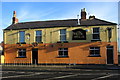
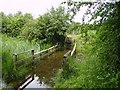
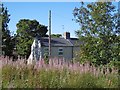
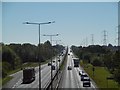

50 photos from this area
Area Information
Key information about the NE13 6EX including its size, population, and administrative classification.
- Area Type
- Postcode
- Area Size
- 1.7 hectares
- Population
- 1353
- Population Density
- 852 people/km²
House Prices in NE13 6EX
53
Properties
£100,010
Average Sold Price
£38,000
Lowest Price
£198,000
Highest Price
Showing 53 properties
| Address | Type | Beds | Baths | Last Sale Price | Last Sale Date | |
|---|---|---|---|---|---|---|
| 14 Chapel Place, Seaton Burn, NE13 6EX | Terraced | 2 | 1 | £87,500 | May 2025 | |
| 23 Chapel Place, Seaton Burn, NE13 6EX | Terraced | 2 | 1 | £132,500 | Nov 2024 | |
| 6 Chapel Place, Seaton Burn, NE13 6EX | Terraced | 2 | 1 | £82,500 | Oct 2024 | |
| 15 Chapel Place, Seaton Burn, NE13 6EX | house | 2 | 1 | £69,000 | Feb 2024 | |
| 24 Chapel Place, Seaton Burn, NE13 6EX | Terraced | 2 | 1 | £136,000 | Apr 2023 | |
| 21 Chapel Place, Seaton Burn, NE13 6EX | house | - | - | £137,000 | Jan 2023 | |
| 51 Chapel Place, Seaton Burn, NE13 6EX | Terraced | 3 | 1 | £157,760 | Oct 2022 | |
| 41 Chapel Place, Seaton Burn, NE13 6EX | Retail | 4 | 1 | £198,000 | Sep 2022 | |
| 36 Chapel Place, Seaton Burn, NE13 6EX | Terraced | 3 | 1 | £120,000 | Mar 2022 | |
| 20 Chapel Place, Seaton Burn, NE13 6EX | Terraced | 3 | 1 | £125,250 | Oct 2021 |
Page 1 of 6
Energy Efficiency in NE13 6EX
Amenities
Schools
| Rank | School | Type | Entry gender | Ages |
|---|
Explore more schools in this area
Go to Schools tabDemographics
Household Size
One person
most common
Accommodation Type
Houses
most common
Tenure
57
majority
Ethnic Group
White
most common
Religion
N/A
most common
Household Composition
N/A
most common
Age
47
median
Adults (30-64 years)
most common
Household Deprivation
N/A
with no deprivation
NS-SEC
29
in Lower managerial occupations
Explore more demographic insights in this area
Go to Demographics tabPlanning
Planning Constraints
- Flood RiskPremium
- Ramsar Wetland SitesPremium
- Area of Outstanding Natural BeautyPremium
- Protected Nature ReservePremium
- Protected WoodlandPremium