Area Overview for NE12 8TU
Photos of NE12 8TU
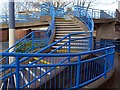

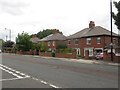
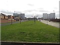
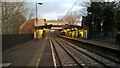

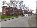
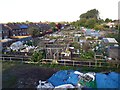
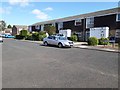
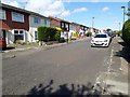
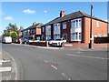
46 photos from this area
Area Information
Key information about the NE12 8TU including its size, population, and administrative classification.
- Area Type
- Postcode
- Area Size
- 5794 m²
- Population
- 1048
- Population Density
- 4717 people/km²
House Prices in NE12 8TU
12
Properties
£107,797
Average Sold Price
£17,780
Lowest Price
£155,500
Highest Price
Showing 12 properties
| Address | Type | Beds | Baths | Last Sale Price | Last Sale Date | |
|---|---|---|---|---|---|---|
| 55 Chesters Avenue, Longbenton, NE12 8TU | house | - | - | £155,500 | Nov 2020 | |
| 65 Chesters Avenue, Longbenton, NE12 8TU | house | - | - | £115,000 | Jun 2016 | |
| 61 Chesters Avenue, Longbenton, NE12 8TU | house | - | - | £132,500 | Mar 2016 | |
| 57 Chesters Avenue, Longbenton, NE12 8TU | house | 3 | - | £101,000 | Dec 2013 | |
| 51 Chesters Avenue, Longbenton, NE12 8TU | Terraced | 3 | - | £125,000 | Apr 2013 | |
| 63 Chesters Avenue, Longbenton, NE12 8TU | Terraced | - | - | £17,780 | Oct 2001 | |
| 71 Chesters Avenue, Longbenton, NE12 8TU | Terraced | 3 | 1 | - | - | |
| 67 Chesters Avenue, Longbenton, NE12 8TU | Terraced | - | - | - | - | |
| 69 Chesters Avenue, Longbenton, NE12 8TU | Terraced | - | - | - | - | |
| 49 Chesters Avenue, Longbenton, NE12 8TU | Terraced | - | - | - | - |
Page 1 of 2
Energy Efficiency in NE12 8TU
Amenities
Schools
| Rank | School | Type | Entry gender | Ages |
|---|
Explore more schools in this area
Go to Schools tabDemographics
Household Size
One person
most common
Accommodation Type
Flats
most common
Tenure
33
majority
Ethnic Group
White
most common
Religion
N/A
most common
Household Composition
N/A
most common
Age
47
median
Adults (30-64 years)
most common
Household Deprivation
N/A
with no deprivation
NS-SEC
25
in Lower managerial occupations
Explore more demographic insights in this area
Go to Demographics tabPlanning
Planning Constraints
- Flood RiskPremium
- Ramsar Wetland SitesPremium
- Area of Outstanding Natural BeautyPremium
- Protected Nature ReservePremium
- Protected WoodlandPremium