Area Overview for NE12 8ER
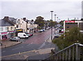
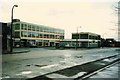
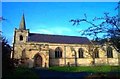
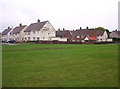
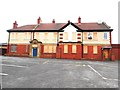
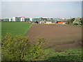
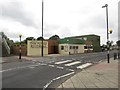
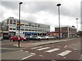
Photos of NE12 8ER

Area Information
NE12 8ER is a compact residential postcode in England, covering just 6.4 hectares yet home to 1,545 residents. Its high population density—24,110 people per square kilometre—reflects a tightly knit community where proximity to amenities and services is a defining feature. This area is characterised by its mix of housing stock, with a strong emphasis on owner-occupied homes. The median age of 47 suggests a mature demographic, with the majority of residents falling within the 30–64 age range. Daily life here is shaped by its accessibility to transport networks, including rail and metro stations, and a range of retail and leisure options within walking distance. While the area’s small size means it is not sprawling, it offers a balance of residential tranquillity and practical connectivity. For those considering living in NE12 8ER, the challenge lies in its limited space, but the rewards include a well-established infrastructure and a community that prioritises convenience over expansion.
- Area Type
- Postcode
- Area Size
- 6.4 hectares
- Population
- 1545
- Population Density
- 2990 people/km²
NE12 8ER is predominantly an owner-occupied area, with 69% of homes owned by their residents rather than rented. The accommodation type is primarily houses, which is unusual for a small postcode area and may indicate a mix of older, larger properties. This suggests a housing stock that is not dominated by flats or apartments, potentially appealing to those seeking more space or a traditional home. However, the limited area size means the property market is constrained, with fewer options for buyers. The high home ownership rate implies a stable market, but it also means rental availability is likely limited. For buyers, this area may offer a sense of community and established infrastructure, though the small footprint means competition for properties could be intense. The focus on houses may also mean that those seeking modern or smaller homes might find fewer options here.
House Prices in NE12 8ER
Showing 1 properties
| Address | Type | Beds | Baths | Last Sale Price | Last Sale Date | |
|---|---|---|---|---|---|---|
| Longbenton High School, Hailsham Avenue, Longbenton, NE12 8ER | commercial | - | - | - | - |
Energy Efficiency in NE12 8ER
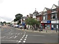
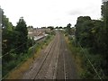
Living in NE12 8ER offers access to a variety of amenities within practical reach. Retail options include Sainsburys Forest, Heron Forest, and Lidl Killingworth, providing everyday shopping convenience. The area’s proximity to metro stations like Benton and Four Lane Ends, along with rail services at Railway Station and Manors Railway Station, supports easy travel for work or leisure. For those who prefer public transport, the Rhodes Street bus stop connects to local routes. Nearby, Newcastle Airport and ferry terminals at Newcastle International and South Shields offer regional and maritime travel options. The mix of retail, transport, and connectivity creates a lifestyle that balances local convenience with broader accessibility. While the area is small, the density of amenities ensures residents can meet most needs without long commutes. This makes NE12 8ER suitable for those who value practicality and proximity to services.
Amenities
Schools
NE12 8ER is served by a range of schools, including Benton Dene Primary School, which holds an outstanding Ofsted rating, and Longbenton High School, rated good. Benton Dene School, a special school, provides additional educational support for specific needs. This mix of primary and special schools offers families a comprehensive option, ensuring both general and specialist education is accessible. The presence of an outstanding primary school suggests high standards in early education, while the special school caters to students requiring tailored support. For parents, this combination reduces the need to travel far for schooling, a key consideration for families. However, the absence of secondary schools in the immediate area may require students to commute to nearby towns. The quality of local schools is a significant factor in the area’s appeal, particularly for those prioritising education for their children.
| Rank | School | Type | Entry gender | Ages |
|---|
Explore more schools in this area
Go to Schools tabDemographics
The population of NE12 8ER is predominantly composed of adults aged 30–64, with a median age of 47. This suggests a community with a strong presence of middle-aged residents, likely including families and professionals. Home ownership is high at 69%, indicating a stable housing market where most residents live in their own homes. The accommodation type is primarily houses, which contrasts with areas dominated by flats or apartments. The predominant ethnic group is White, though no specific data on diversity or deprivation is provided. The age profile implies a population that may be nearing retirement or in their peak working years, with potential implications for local services and amenities. The high home ownership rate and focus on owner-occupied housing suggest a community with long-term residency, though the area’s small size means it lacks the demographic diversity seen in larger urban centres.
Household Size
Accommodation Type
Tenure
Ethnic Group
Religion
Household Composition
Age
Household Deprivation
NS-SEC
Explore more demographic insights in this area
Go to Demographics tabPlanning
Planning Constraints
- Flood RiskPremium
- Ramsar Wetland SitesPremium
- Area of Outstanding Natural BeautyPremium
- Protected Nature ReservePremium
- Protected WoodlandPremium