Area Overview for NE12 6UR
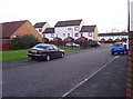
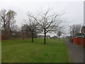
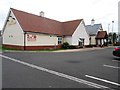
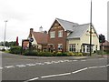
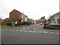
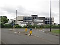
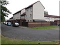
Photos of NE12 6UR


Area Information
NE12 6UR is a small residential postcode area in England, home to 1,776 residents. It is a compact cluster of homes, predominantly occupied by adults aged 30–64, reflecting a mature, stable community. Daily life here is shaped by proximity to local amenities, schools, and transport links. The area’s modest size means it is likely to feel close-knit, with residents accustomed to a slower pace of life compared to larger urban centres. While not a sprawling suburb, NE12 6UR offers access to essential services within practical reach, including retail outlets, public transport, and schools. The population density is low, which may appeal to those seeking space without sacrificing convenience. Its location, while not in a major city, is well-connected to nearby towns and cities via rail, bus, and road networks. For buyers, this area represents a balance between tranquillity and accessibility, though its small footprint means it is best suited to those prioritising community over expansive surroundings.
- Area Type
- Postcode
- Area Size
- Not available
- Population
- 1776
- Population Density
- Not available
NE12 6UR is primarily an owner-occupied area, with 63% of residents living in homes they own. The accommodation type is predominantly houses, which is unusual for areas with higher flat or apartment density. This suggests a housing stock tailored to families or individuals seeking more space, rather than rental-focused developments. The small size of the postcode area means the property market is likely limited to a handful of homes, making it a niche market for buyers seeking specific locations. The lack of flats or shared housing implies limited options for renters or first-time buyers looking for affordability. For those considering purchase, the area’s stability and home ownership rates suggest a low-risk investment, though the small scale means competition for properties could be fierce. Buyers should focus on proximity to nearby amenities, as the area’s value may be closely tied to its connectivity rather than intrinsic features.
House Prices in NE12 6UR
No properties found in this postcode.
Energy Efficiency in NE12 6UR
Residents of NE12 6UR have access to a range of amenities within practical reach, including retail, dining, and transport options. The area is served by five retail outlets, including Morrisons Killingworth, Lidl Killingworth, and Aldi Longbenton, providing everyday shopping convenience. Nearby metro areas like Palmersville and Four Lane Ends offer additional commercial and leisure facilities. The presence of multiple rail stations and bus routes ensures easy access to larger towns and cities. For leisure, the area’s proximity to ferry terminals and airports may appeal to those interested in travel or tourism. While specific parks or green spaces are not listed in the data, the absence of protected natural areas suggests a focus on practical amenities over recreational landscapes. The lifestyle here is defined by accessibility to essentials, with a balance between local convenience and regional connectivity.
Amenities
Schools
Residents of NE12 6UR have access to a range of schools, including primary and special education institutions. Forest Hall Primary School and George Stephenson High School both hold Ofsted ratings of 'good', indicating a solid standard of education. St Marys Roman Catholic Primary School Aided and Killingworth Middle School are also nearby, though their Ofsted ratings are not specified. Percy Hedley School, a special needs institution, provides tailored support for students with specific requirements. The mix of school types ensures families can choose between mainstream education and specialist provision. For parents, the presence of two 'good' rated schools is a positive, though the absence of secondary school ratings for some institutions may raise questions about consistency. The proximity of these schools within practical reach of homes in NE12 6UR makes it a viable option for families prioritising education quality.
| Rank | School | Type | Entry gender | Ages |
|---|
Explore more schools in this area
Go to Schools tabDemographics
The population of NE12 6UR is predominantly adults aged 30–64, with a median age of 47. This suggests a community of established professionals, families, and retirees. Home ownership is high, with 63% of residents owning their homes, indicating a stable housing market. The area is characterised by houses rather than flats or apartments, which aligns with the demographic profile of older, family-oriented households. The predominant ethnic group is White, though no specific data on diversity or deprivation levels is provided. The absence of detailed diversity statistics means the community’s cultural makeup remains unspecified. For quality of life, the high home ownership rate and mature age profile suggest a low turnover of residents, fostering a sense of continuity. However, the lack of specific data on deprivation or income levels means broader socioeconomic context remains unclear.
Household Size
Accommodation Type
Tenure
Ethnic Group
Religion
Household Composition
Age
Household Deprivation
NS-SEC
Explore more demographic insights in this area
Go to Demographics tabPlanning
Planning Constraints
- Flood RiskPremium
- Ramsar Wetland SitesPremium
- Area of Outstanding Natural BeautyPremium
- Protected Nature ReservePremium
- Protected WoodlandPremium