Area Overview for NE12 6DL
Photos of NE12 6DL
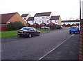


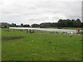


37 photos from this area
Area Information
Key information about the NE12 6DL including its size, population, and administrative classification.
- Area Type
- Postcode
- Area Size
- 1.1 hectares
- Population
- 1776
- Population Density
- 2456 people/km²
House Prices in NE12 6DL
52
Properties
£109,655
Average Sold Price
£66,500
Lowest Price
£140,500
Highest Price
Showing 52 properties
| Address | Type | Beds | Baths | Last Sale Price | Last Sale Date | |
|---|---|---|---|---|---|---|
| 9, Regency Apartments, Citadel East, Killingworth, NE12 6DL | Flat | 2 | 1 | £87,500 | Mar 2025 | |
| 48, Regency Apartments, Citadel East, Killingworth, NE12 6DL | Flat | 2 | 1 | £80,000 | Jan 2025 | |
| 47, Regency Apartments, Citadel East, Killingworth, NE12 6DL | Flat | 2 | - | £86,250 | Oct 2023 | |
| 2, Regency Apartments, Citadel East, Killingworth, NE12 6DL | Flat | - | - | £90,000 | Jun 2023 | |
| 5, Regency Apartments, Citadel East, Killingworth, NE12 6DL | Flat | 2 | 1 | £95,000 | Jun 2022 | |
| 6, Regency Apartments, Citadel East, Killingworth, NE12 6DL | Flat | 2 | 1 | £80,000 | Apr 2022 | |
| 15, Regency Apartments, Citadel East, Killingworth, NE12 6DL | Flat | - | - | £66,500 | Jan 2021 | |
| 51, Regency Apartments, Citadel East, Killingworth, NE12 6DL | Flat | - | - | £70,000 | Dec 2017 | |
| 34, Regency Apartments, Citadel East, Killingworth, NE12 6DL | Flat | - | - | £88,000 | May 2016 | |
| 39, Regency Apartments, Citadel East, Killingworth, NE12 6DL | Flat | - | - | £130,000 | Dec 2005 |
Page 1 of 6
Energy Efficiency in NE12 6DL
Amenities
Schools
| Rank | School | Type | Entry gender | Ages |
|---|
Explore more schools in this area
Go to Schools tabDemographics
Household Size
One person
most common
Accommodation Type
Houses
most common
Tenure
63
majority
Ethnic Group
White
most common
Religion
N/A
most common
Household Composition
N/A
most common
Age
47
median
Adults (30-64 years)
most common
Household Deprivation
N/A
with no deprivation
NS-SEC
38
in Lower managerial occupations
Explore more demographic insights in this area
Go to Demographics tabPlanning
Planning Constraints
- Flood RiskPremium
- Ramsar Wetland SitesPremium
- Area of Outstanding Natural BeautyPremium
- Protected Nature ReservePremium
- Protected WoodlandPremium