Area Overview for NE11 9TX
Photos of NE11 9TX
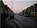
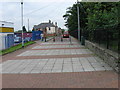
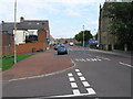

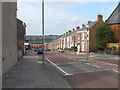
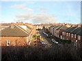

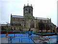
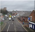

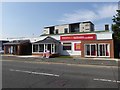

67 photos from this area
Area Information
Key information about the NE11 9TX including its size, population, and administrative classification.
- Area Type
- Postcode
- Area Size
- 1.2 hectares
- Population
- 1490
- Population Density
- 121307 people/km²
House Prices in NE11 9TX
24
Properties
£150,978
Average Sold Price
£27,200
Lowest Price
£241,000
Highest Price
Showing 24 properties
| Address | Type | Beds | Baths | Last Sale Price | Last Sale Date | |
|---|---|---|---|---|---|---|
| 7 Peacock Court, Festival Park, Gateshead, NE11 9TX | Detached | 3 | 1 | £241,000 | Jul 2025 | |
| 10 Peacock Court, Festival Park, Gateshead, NE11 9TX | Semi-detached | 2 | - | £154,000 | Sep 2023 | |
| 12 Peacock Court, Festival Park, Gateshead, NE11 9TX | Detached | 3 | 1 | £195,000 | Apr 2022 | |
| 9 Peacock Court, Festival Park, Gateshead, NE11 9TX | house | - | - | £187,000 | Jul 2020 | |
| 11 Peacock Court, Festival Park, Gateshead, NE11 9TX | house | - | - | £146,000 | Aug 2019 | |
| 14 Peacock Court, Festival Park, Gateshead, NE11 9TX | Semi-detached | 3 | - | £159,950 | Dec 2018 | |
| 13 Peacock Court, Festival Park, Gateshead, NE11 9TX | house | - | - | £195,000 | May 2018 | |
| 16 Peacock Court, Festival Park, Gateshead, NE11 9TX | Detached | 3 | 2 | £195,000 | Dec 2017 | |
| 19 Peacock Court, Festival Park, Gateshead, NE11 9TX | Detached | 3 | - | £175,000 | Jun 2016 | |
| 15 Peacock Court, Festival Park, Gateshead, NE11 9TX | house | - | - | £150,000 | Dec 2014 |
Page 1 of 3
Energy Efficiency in NE11 9TX
Amenities
Schools
| Rank | School | Type | Entry gender | Ages |
|---|
Explore more schools in this area
Go to Schools tabDemographics
Household Size
Two person
most common
Accommodation Type
Houses
most common
Tenure
90
majority
Ethnic Group
White
most common
Religion
N/A
most common
Household Composition
N/A
most common
Age
47
median
Adults (30-64 years)
most common
Household Deprivation
N/A
with no deprivation
NS-SEC
35
in Lower managerial occupations
Explore more demographic insights in this area
Go to Demographics tabPlanning
Planning Constraints
- Flood RiskPremium
- Ramsar Wetland SitesPremium
- Area of Outstanding Natural BeautyPremium
- Protected Nature ReservePremium
- Protected WoodlandPremium