Area Overview for NE11 9TW
Photos of NE11 9TW

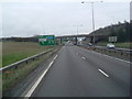


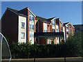
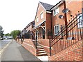
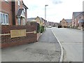


41 photos from this area
Area Information
Key information about the NE11 9TW including its size, population, and administrative classification.
- Area Type
- Postcode
- Area Size
- 1.0 hectares
- Population
- 1490
- Population Density
- 148904 people/km²
House Prices in NE11 9TW
22
Properties
£155,979
Average Sold Price
£46,000
Lowest Price
£308,750
Highest Price
Showing 22 properties
| Address | Type | Beds | Baths | Last Sale Price | Last Sale Date | |
|---|---|---|---|---|---|---|
| 18 Red Admiral Court, Festival Park, Gateshead, NE11 9TW | house | - | - | £230,000 | Jan 2025 | |
| 20 Red Admiral Court, Festival Park, Gateshead, NE11 9TW | house | - | - | £298,000 | Dec 2021 | |
| 21 Red Admiral Court, Festival Park, Gateshead, NE11 9TW | house | - | - | £170,000 | Jun 2021 | |
| 12 Red Admiral Court, Festival Park, Gateshead, NE11 9TW | house | - | - | £265,000 | Jun 2021 | |
| 8 Red Admiral Court, Festival Park, Gateshead, NE11 9TW | Semi-detached | 3 | 2 | £150,000 | Mar 2021 | |
| 3 Red Admiral Court, Festival Park, Gateshead, NE11 9TW | house | - | - | £308,750 | Dec 2020 | |
| 13 Red Admiral Court, Festival Park, Gateshead, NE11 9TW | Detached | 5 | - | £265,000 | Jun 2015 | |
| 11 Red Admiral Court, Festival Park, Gateshead, NE11 9TW | Semi-detached | - | - | £136,000 | May 2004 | |
| 1 Red Admiral Court, Festival Park, Gateshead, NE11 9TW | Detached | - | - | £177,950 | Dec 2003 | |
| 10 Red Admiral Court, Festival Park, Gateshead, NE11 9TW | Semi-detached | - | - | £66,500 | Jun 2001 |
Page 1 of 3
Energy Efficiency in NE11 9TW
Amenities
Schools
| Rank | School | Type | Entry gender | Ages |
|---|
Explore more schools in this area
Go to Schools tabDemographics
Household Size
Two person
most common
Accommodation Type
Houses
most common
Tenure
90
majority
Ethnic Group
White
most common
Religion
N/A
most common
Household Composition
N/A
most common
Age
47
median
Adults (30-64 years)
most common
Household Deprivation
N/A
with no deprivation
NS-SEC
35
in Lower managerial occupations
Explore more demographic insights in this area
Go to Demographics tabPlanning
Planning Constraints
- Flood RiskPremium
- Ramsar Wetland SitesPremium
- Area of Outstanding Natural BeautyPremium
- Protected Nature ReservePremium
- Protected WoodlandPremium