Area Overview for NE11 9SP
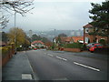
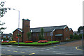
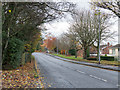
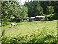
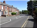
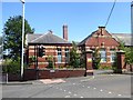
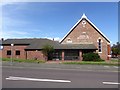
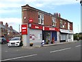
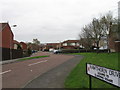
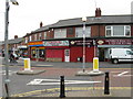
Photos of NE11 9SP


Area Information
Living in NE11 9SP means inhabiting a tightly knit residential cluster in northeast England, where 1,619 residents live at a density of 1,542 people per square kilometre. This small postcode area reflects a mature community, with a median age of 47 and a majority of residents aged 30–64. The area’s compact size means amenities and services are within close reach, though its character is defined by quiet, established housing rather than sprawling development. Daily life here balances proximity to transport hubs with a sense of local cohesion. The area’s appeal lies in its practicality: it is served by multiple rail stations, including Dunston and Metrocentre, and has access to retail outlets like Aldi Dunston and Costco Gateshead. While not a bustling urban centre, NE11 9SP offers a straightforward, functional lifestyle suited to those prioritising convenience over city vibrancy. Its small footprint means the community is tightly connected, with a focus on family-oriented living reflected in the local schools and housing stock.
- Area Type
- Postcode
- Area Size
- Not available
- Population
- 1619
- Population Density
- 1542 people/km²
The property market in NE11 9SP is defined by a 54% home ownership rate, indicating that nearly half of properties are owner-occupied, while the remainder are likely rented. The accommodation type is predominantly houses, which suggests a focus on family homes rather than apartments or flats. This aligns with the area’s mature demographic, where residents aged 30–64 may prioritise space and stability. As a small postcode area, the housing stock is limited, meaning buyers should consider nearby neighbourhoods for broader options. The prevalence of houses may also imply a slower turnover of properties, with fewer new developments. For buyers, this means competition for available homes could be higher, but the existing stock offers a clear picture of what to expect in terms of size, layout, and location. The lack of rental data means it is unclear how much of the market is driven by tenants, but the ownership rate suggests a balanced mix.
House Prices in NE11 9SP
No properties found in this postcode.
Energy Efficiency in NE11 9SP
The lifestyle in NE11 9SP is shaped by its proximity to retail, transport, and community hubs. Within walking distance are major retailers like Aldi Dunston and Costco Gateshead, offering everyday shopping needs. The area’s rail and metro stations, including Dunston and Metrocentre, provide swift access to larger cities, while the Metro network connects to Central Station and St James. Though there are no named parks or leisure facilities in the data, the presence of multiple schools and transport links suggests a focus on practicality over recreational spaces. The compact nature of the area means amenities are tightly clustered, reducing the need for long commutes. For residents, this translates to a lifestyle that prioritises convenience: shopping, transport, and education are all within easy reach, though the absence of specific leisure venues may require venturing slightly further afield for dining or entertainment.
Amenities
Schools
NE11 9SP is served by three primary schools: Dunston Hill Community Primary School and Dunston Hill Infant School, both rated ‘good’ by Ofsted, and Kingsmeadow Community School, also rated ‘good’. These institutions provide a range of primary education options for families in the area. The presence of two infant schools suggests a focus on early education, catering to younger children in the community. While no secondary schools are listed, the proximity to rail and metro stations may offer access to larger educational institutions nearby. The consistent ‘good’ Ofsted ratings indicate that local schools meet acceptable standards, though parents seeking higher-performing schools may need to look beyond the immediate area. The clustering of primary schools supports family needs, but the absence of secondary education within the postcode means students may need to commute for secondary schooling.
| Rank | School | Type | Entry gender | Ages |
|---|
Explore more schools in this area
Go to Schools tabDemographics
NE11 9SP’s population skews towards adults aged 30–64, with a median age of 47. This suggests a community rooted in middle-aged households, likely with established careers and families. Home ownership stands at 54%, indicating a mix of owner-occupied properties and rental units. The predominant accommodation type is houses, which aligns with the area’s residential character. The predominant ethnic group is White, though no specific data on diversity or minority populations is provided. The absence of detailed deprivation metrics means it is unclear how economic factors shape quality of life, but the high home ownership rate and age profile suggest a stable, settled population. This demographic profile implies a community focused on long-term living rather than transient rental markets, with a strong emphasis on family-oriented housing.
Household Size
Accommodation Type
Tenure
Ethnic Group
Religion
Household Composition
Age
Household Deprivation
NS-SEC
Explore more demographic insights in this area
Go to Demographics tabPlanning
Planning Constraints
- Flood RiskPremium
- Ramsar Wetland SitesPremium
- Area of Outstanding Natural BeautyPremium
- Protected Nature ReservePremium
- Protected WoodlandPremium