Area Overview for NE11 9QH
Photos of NE11 9QH
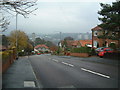
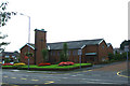
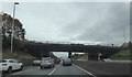
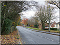
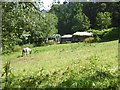
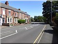
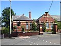
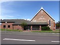
24 photos from this area
Area Information
Key information about the NE11 9QH including its size, population, and administrative classification.
- Area Type
- Postcode
- Area Size
- 17.5 hectares
- Population
- 1388
- Population Density
- 835 people/km²
House Prices in NE11 9QH
9
Properties
£199,042
Average Sold Price
£90,000
Lowest Price
£430,000
Highest Price
Showing 9 properties
| Address | Type | Beds | Baths | Last Sale Price | Last Sale Date | |
|---|---|---|---|---|---|---|
| Westoe, Whickham Highway, Whickham, NE11 9QH | Bungalow | 3 | 1 | £330,000 | Sep 2022 | |
| Windyridge, Whickham Highway, Whickham, NE11 9QH | Bungalow | - | - | £430,000 | Sep 2021 | |
| Rahana, Whickham Highway, Whickham, NE11 9QH | Detached | - | - | £90,000 | Dec 1998 | |
| Holme Bank, Whickham Highway, Whickham, NE11 9QH | Detached | - | - | £105,000 | May 1998 | |
| Oakwood, Whickham Highway, Whickham, NE11 9QH | Detached | - | - | £125,000 | May 1997 | |
| Dundonald, Whickham Highway, Whickham, NE11 9QH | Detached | 4 | 2 | £114,250 | Dec 1996 | |
| Lambert House, Whickham Highway, Whickham, NE11 9QH | Detached | - | - | - | - | |
| Hillcrest, Whickham Highway, Whickham, NE11 9QH | Detached | - | - | - | - | |
| Stamullen, Whickham Highway, Whickham, NE11 9QH | house | - | - | - | - |
Energy Efficiency in NE11 9QH
Amenities
Schools
| Rank | School | Type | Entry gender | Ages |
|---|
Explore more schools in this area
Go to Schools tabDemographics
Household Size
Two person
most common
Accommodation Type
Houses
most common
Tenure
77
majority
Ethnic Group
White
most common
Religion
N/A
most common
Household Composition
N/A
most common
Age
47
median
Adults (30-64 years)
most common
Household Deprivation
N/A
with no deprivation
NS-SEC
36
in Lower managerial occupations
Explore more demographic insights in this area
Go to Demographics tabPlanning
Planning Constraints
- Flood RiskPremium
- Ramsar Wetland SitesPremium
- Area of Outstanding Natural BeautyPremium
- Protected Nature ReservePremium
- Protected WoodlandPremium