Area Overview for NE11 9ND
Photos of NE11 9ND


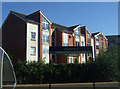
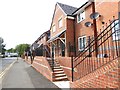
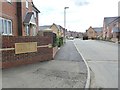

41 photos from this area
Area Information
Key information about the NE11 9ND including its size, population, and administrative classification.
- Area Type
- Postcode
- Area Size
- 7.9 hectares
- Population
- 1490
- Population Density
- 2074 people/km²
House Prices in NE11 9ND
47
Properties
£207,058
Average Sold Price
£92,995
Lowest Price
£400,000
Highest Price
Showing 47 properties
| Address | Type | Beds | Baths | Last Sale Price | Last Sale Date | |
|---|---|---|---|---|---|---|
| 24 Grayling Road, Festival Park, Gateshead, NE11 9ND | Detached | 4 | 2 | £330,000 | Jun 2025 | |
| 2 Grayling Road, Festival Park, Gateshead, NE11 9ND | Detached | 4 | 2 | £315,000 | Jul 2024 | |
| 42 Grayling Road, Festival Park, Gateshead, NE11 9ND | house | 4 | 2 | £375,000 | Apr 2024 | |
| 5 Grayling Road, Festival Park, Gateshead, NE11 9ND | Retail | 4 | 1 | £400,000 | Oct 2022 | |
| 46 Grayling Road, Festival Park, Gateshead, NE11 9ND | house | - | - | £295,000 | Apr 2022 | |
| 13 Grayling Road, Festival Park, Gateshead, NE11 9ND | house | - | - | £345,000 | Jun 2021 | |
| 1 Grayling Road, Festival Park, Gateshead, NE11 9ND | Detached | 4 | - | £300,000 | Nov 2020 | |
| 12 Grayling Road, Festival Park, Gateshead, NE11 9ND | Detached | 4 | 2 | £283,000 | Jun 2019 | |
| 38 Grayling Road, Festival Park, Gateshead, NE11 9ND | house | 3 | 2 | £265,000 | Jan 2019 | |
| 31 Grayling Road, Festival Park, Gateshead, NE11 9ND | house | - | - | £280,000 | Jul 2018 |
Page 1 of 5
Energy Efficiency in NE11 9ND
Amenities
Schools
| Rank | School | Type | Entry gender | Ages |
|---|
Explore more schools in this area
Go to Schools tabDemographics
Household Size
Two person
most common
Accommodation Type
Houses
most common
Tenure
90
majority
Ethnic Group
White
most common
Religion
N/A
most common
Household Composition
N/A
most common
Age
47
median
Adults (30-64 years)
most common
Household Deprivation
N/A
with no deprivation
NS-SEC
35
in Lower managerial occupations
Explore more demographic insights in this area
Go to Demographics tabPlanning
Planning Constraints
- Flood RiskPremium
- Ramsar Wetland SitesPremium
- Area of Outstanding Natural BeautyPremium
- Protected Nature ReservePremium
- Protected WoodlandPremium