Area Overview for NE11 9JG
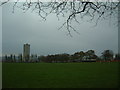
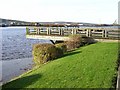
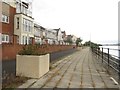
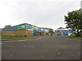
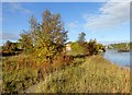
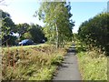
Photos of NE11 9JG


Area Information
NE11 9JG is a compact residential postcode in England, covering just 5,764 square metres and home to 1,619 residents. Its high population density of 1,542 people per square kilometre reflects a tightly knit community, typical of smaller urban clusters. The area is defined by its proximity to key amenities, including multiple schools, retail outlets, and transport hubs. While it lacks sprawling green spaces, its strategic location offers easy access to nearby towns and cities. Daily life here is shaped by the balance between residential calm and the vibrancy of nearby commercial zones. Residents benefit from a mix of local shops, such as Aldi Dunston and Costco Gateshead, and efficient transport links, including Metrocentre Railway Station and Dunston Railway Station. The area’s small size means it is ideal for those seeking a manageable, community-focused environment without the isolation of more remote locations. With a median age of 47 and a majority of adults aged 30–64, the demographic suggests a stable, family-oriented population. For buyers, NE11 9JG offers a blend of practicality and accessibility, though its limited size means choices are focused on nearby extensions of the area.
- Area Type
- Postcode
- Area Size
- 5764 m²
- Population
- 1619
- Population Density
- 1542 people/km²
The property market in NE11 9JG is characterised by a 54% home ownership rate, with houses being the predominant accommodation type. This suggests a focus on family homes rather than rental properties, though the small area size means the housing stock is limited. The high population density of 1,542 people per square kilometre indicates that properties are likely to be closely spaced, with little scope for large-scale development. For buyers, this means the available homes are concentrated within a small geographical footprint, requiring careful consideration of proximity to amenities and transport links. The presence of multiple primary schools and retail outlets nearby may enhance the area’s desirability, particularly for families. However, the limited size of NE11 9JG means that property choices are constrained, and buyers may need to look to adjacent areas for additional options. The market appears to cater more to owner-occupiers than renters, reflecting the demographic’s stability and long-term residency.
House Prices in NE11 9JG
No properties found in this postcode.
Energy Efficiency in NE11 9JG
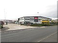
Living in NE11 9JG offers a blend of convenience and local amenities. Residents have access to retail outlets such as M&S Metro, Costco Gateshead, and Aldi Dunston, providing a range of shopping options within walking distance. The area’s transport links, including Metrocentre Railway Station and Dunston Railway Station, make it easy to reach larger towns and cities. For leisure, the proximity to Newcastle Airport and nearby parks, though not explicitly named in the data, suggests opportunities for recreation. The presence of multiple primary schools and community-focused services indicates a family-friendly environment. While the data does not specify parks or leisure facilities, the high population density implies that public spaces may be limited. The area’s compact size means amenities are concentrated, reducing the need for long journeys. Overall, daily life in NE11 9JG is shaped by its proximity to essential services and transport, though the small footprint may require residents to look beyond the immediate area for more extensive facilities.
Amenities
Schools
Residents of NE11 9JG have access to three primary schools within practical reach: Dunston Hill Community Primary School, Kingsmeadow Community School, and Dunston Hill Infant School. Both Dunston Hill Community Primary School and Kingsmeadow Community School hold 'good' Ofsted ratings, indicating a solid standard of education. Dunston Hill Infant School, however, does not have a listed Ofsted rating, which may raise questions about its performance. The availability of multiple primary schools within a short distance is a significant advantage for families, reducing the need for long commutes. The presence of two schools rated 'good' suggests a competitive educational landscape, which can be beneficial for parents seeking quality schooling. However, the absence of secondary schools in the immediate area means students may need to travel to nearby towns for further education. This mix of school types reflects a focus on early education, with the area’s small size limiting the scope for larger educational institutions.
| Rank | School | Type | Entry gender | Ages |
|---|
Explore more schools in this area
Go to Schools tabDemographics
The community in NE11 9JG is predominantly composed of adults aged 30–64, with a median age of 47. This suggests a mature population, likely with established careers and families. Home ownership rates stand at 54%, indicating a mix of owner-occupied properties and rental units. The accommodation type is primarily houses, which is notable in a high-density area, suggesting a focus on family homes rather than flats. The predominant ethnic group is White, reflecting the broader demographic trends in the region. While no specific data on deprivation is provided, the age profile and home ownership figures imply a relatively stable economic environment. The presence of multiple primary schools, including Dunston Hill Community Primary School and Kingsmeadow Community School, both rated 'good' by Ofsted, supports the area’s appeal to families. However, the lack of detailed diversity metrics means the full range of community experiences cannot be fully assessed. The high population density, combined with a mature demographic, points to a neighbourhood where social networks are likely well-established.
Household Size
Accommodation Type
Tenure
Ethnic Group
Religion
Household Composition
Age
Household Deprivation
NS-SEC
Explore more demographic insights in this area
Go to Demographics tabPlanning
Planning Constraints
- Flood RiskPremium
- Ramsar Wetland SitesPremium
- Area of Outstanding Natural BeautyPremium
- Protected Nature ReservePremium
- Protected WoodlandPremium