Area Overview for NE11 9HW
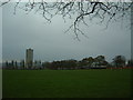
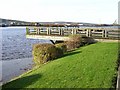
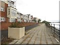
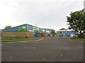
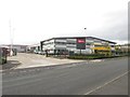
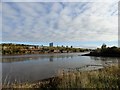
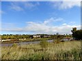
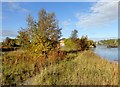
Photos of NE11 9HW


Area Information
NE11 9HW is a small, tightly knit residential postcode in England, home to 1,619 people spread across a compact area. With a population density of 1,542 people per square kilometre, it reflects a mix of established homes and community-focused living. The area is characterised by its proximity to retail hubs and transport links, making it practical for daily life. Residents here are predominantly adults aged 30–64, with a median age of 47, suggesting a mature, settled community. The presence of multiple primary schools and nearby amenities indicates a family-friendly environment, though the small size of the postcode means the area is best suited for those prioritising convenience over expansive space. Living in NE11 9HW offers a blend of accessibility and local cohesion, with homes primarily in the private sector and a strong focus on proximity to essential services. It is a place where daily routines are shaped by the immediate surroundings, from school runs to shopping trips, with minimal need for long commutes.
- Area Type
- Postcode
- Area Size
- Not available
- Population
- 1619
- Population Density
- 1542 people/km²
The property market in NE11 9HW is defined by a 54% home ownership rate, with houses being the predominant accommodation type. This indicates a residential area where private ownership is common, though rental options also exist. The small postcode size means the housing stock is limited, potentially creating a competitive market for buyers. The focus on houses rather than flats or apartments suggests a preference for traditional, family-friendly properties. For buyers, this means a market that may prioritise stability and long-term investment over short-term rental opportunities. The proximity to retail and transport hubs could enhance property value, but the limited number of homes means buyers should consider the availability of properties in the immediate vicinity. The mix of ownership and rental properties also implies a balance between established residents and those seeking more flexible housing solutions.
House Prices in NE11 9HW
No properties found in this postcode.
Energy Efficiency in NE11 9HW
Living in NE11 9HW offers access to a range of amenities that support daily life. Retail options include M&S Metro, Costco Gateshead, and Aldi Dunston, providing convenience for shopping trips. The area’s rail and metro stations, such as Metrocentre and Dunston, connect residents to broader networks, while the bus stop at Rhodes Street adds local mobility. Proximity to Newcastle Airport ensures easy travel for those requiring regional or international connections. The presence of multiple schools and the compact nature of the postcode suggest a community-oriented lifestyle, where essential services are within reach. The mix of retail, transport, and leisure options reflects a practical, accessible environment, ideal for those prioritising convenience without sacrificing connectivity.
Amenities
Schools
Residents of NE11 9HW have access to three primary schools within practical reach. Dunston Hill Community Primary School and Dunston Hill Infant School both hold a 'good' Ofsted rating, offering a reliable educational foundation for younger children. Kingsmeadow Community School also provides a 'good' rating, adding to the range of primary options. The presence of multiple primary schools suggests a strong focus on education in the area, with families able to choose between different institutions. The mix of schools may cater to varying educational philosophies or needs, though no secondary schools are listed in the data. For parents, the availability of rated primary schools is a key advantage, ensuring children have access to quality early education without the need for long commutes.
| Rank | School | Type | Entry gender | Ages |
|---|
Explore more schools in this area
Go to Schools tabDemographics
The community in NE11 9HW is predominantly composed of adults aged 30–64, making up the most common age range, with a median age of 47. This suggests a stable, established population with a focus on long-term residency. Home ownership rates stand at 54%, indicating a mix of owner-occupied properties and rental homes. The accommodation type is primarily houses, reflecting a residential character that contrasts with high-density housing. The predominant ethnic group is White, though no specific data on diversity or deprivation is provided. The age profile implies a community with a strong presence of working-age individuals and families, likely contributing to a steady local economy. With no data on deprivation, it is difficult to assess broader socioeconomic factors, but the ownership and age demographics suggest a relatively settled population with a focus on family-oriented living.
Household Size
Accommodation Type
Tenure
Ethnic Group
Religion
Household Composition
Age
Household Deprivation
NS-SEC
Explore more demographic insights in this area
Go to Demographics tabPlanning
Planning Constraints
- Flood RiskPremium
- Ramsar Wetland SitesPremium
- Area of Outstanding Natural BeautyPremium
- Protected Nature ReservePremium
- Protected WoodlandPremium