Area Overview for NE11 0UY
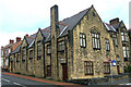
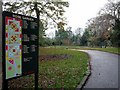
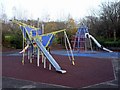
Photos of NE11 0UY


Area Information
Living in NE11 0UY means being part of a small, tightly knit residential cluster in England with a population of 2126. The area is characterised by a quiet, established feel, with a median age of 47 and a majority of residents aged between 30 and 64. This suggests a community of long-term residents, many of whom are likely to be homeowners, given the 63% home ownership rate. The area is not densely populated, offering a balance between privacy and proximity to essential services. Daily life here is shaped by its modest scale, with residents relying on nearby amenities such as retail outlets, transport hubs, and schools. While the area lacks large-scale attractions, its practicality and accessibility make it suitable for those prioritising convenience over urban vibrancy. The presence of multiple rail stations and metro connections ensures reasonable links to nearby towns, while the broadband score of 97 indicates reliable digital infrastructure. For those seeking a low-maintenance, stable environment with a focus on practical living, NE11 0UY offers a straightforward, no-frills option.
- Area Type
- Postcode
- Area Size
- Not available
- Population
- 2126
- Population Density
- 2556 people/km²
The property market in NE11 0UY is dominated by owner-occupied homes, with 63% of residents owning their properties. The accommodation type is primarily houses, which suggests a focus on traditional, single-family dwellings rather than apartments or flats. This makes the area more appealing to buyers seeking space and privacy, though the small size of the postcode may limit the availability of properties. The housing stock is likely to be older, given the median age of residents, which could influence the condition and style of homes. For buyers, this means a market that prioritises stability and long-term ownership over rental opportunities. The proximity to transport links and amenities may enhance the area’s appeal, but the limited size of NE11 0UY means that properties are unlikely to be abundant. Buyers should consider the practicality of the location and the need for a car, given the lack of extensive public transport networks.
House Prices in NE11 0UY
No properties found in this postcode.
Energy Efficiency in NE11 0UY
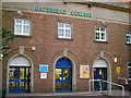
The lifestyle in NE11 0UY is shaped by its proximity to essential amenities, including five retail outlets such as Heron Durham, Spar, and Co-op Low, which cater to everyday shopping needs. The area’s transport links provide access to leisure and entertainment options in nearby metro areas like Gateshead Stadium and Felling. Rail stations such as Dunston and Manors offer connections to broader regional networks, facilitating travel to cultural or recreational hubs. While the data does not mention parks or green spaces, the absence of protected nature reserves or AONB designations suggests that the area is not constrained by environmental restrictions. The practical reach of amenities means residents can access shops, dining, and transport without significant travel. However, the lack of detailed information on leisure facilities means the area’s character is defined more by its functional, community-oriented services than by large-scale attractions.
Amenities
Schools
The nearest school to NE11 0UY is Heathfield Senior High School, a primary school serving the local community. While no Ofsted rating is provided, the presence of a single primary school suggests that families in the area may have limited options for primary education. The school’s location within practical reach of residents indicates that it is a central feature of the local infrastructure. Given the area’s median age and home ownership rate, it is likely that many households include children in the primary school age range. However, the absence of secondary schools or additional educational institutions in the data means that families may need to look beyond NE11 0UY for comprehensive schooling. This could be a consideration for those prioritising a range of educational choices.
| Rank | School | Type | Entry gender | Ages |
|---|
Explore more schools in this area
Go to Schools tabDemographics
The community in NE11 0UY is predominantly composed of adults aged 30 to 64, with a median age of 47. This suggests a mature population, likely consisting of families and individuals in their middle years. Home ownership is strong, with 63% of residents owning their homes, indicating a stable and settled demographic. The accommodation type is primarily houses, which aligns with the area’s residential character and suggests a focus on single-family living rather than high-density housing. The predominant ethnic group is White, reflecting a homogenous community profile. While no specific data on deprivation is provided, the high home ownership rate and moderate age range imply a relatively stable economic environment. The absence of significant diversity data means the community’s social fabric is likely shaped by long-standing local ties rather than recent demographic shifts.
Household Size
Accommodation Type
Tenure
Ethnic Group
Religion
Household Composition
Age
Household Deprivation
NS-SEC
Explore more demographic insights in this area
Go to Demographics tabPlanning
Planning Constraints
- Flood RiskPremium
- Ramsar Wetland SitesPremium
- Area of Outstanding Natural BeautyPremium
- Protected Nature ReservePremium
- Protected WoodlandPremium