Area Overview for NE11 0UQ
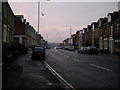
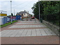
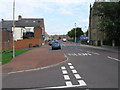
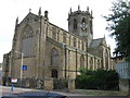
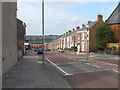
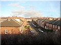
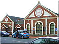
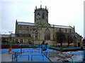
Photos of NE11 0UQ
Area Information
NE11 0UQ is a compact residential postcode in England, home to 2018 residents spread across a densely populated area with 687 people per square kilometre. This small cluster of homes is characterised by its proximity to key amenities and transport links, making it a practical choice for those seeking convenience without sacrificing space. The area’s demographic profile suggests a mature community, with a median age of 47 and a majority of residents aged 30–64. While the population is relatively small, the area’s strategic location offers access to retail, rail, and metro services within walking or short driving distance. Daily life here balances suburban tranquillity with urban accessibility, though the high crime risk reported in assessments warrants careful consideration. For buyers prioritising connectivity and proximity to essential services, NE11 0UQ presents a focused opportunity, though its limited size means the local character is shaped heavily by nearby developments and infrastructure.
- Area Type
- Postcode
- Area Size
- Not available
- Population
- 2018
- Population Density
- 687 people/km²
The property market in NE11 0UQ is defined by a 34% home ownership rate, suggesting that less than a third of properties are owner-occupied, with the remainder likely rented. The accommodation type is predominantly houses, which may indicate a focus on family homes or larger residences. Given the area’s small size, the housing stock is limited, and buyers should consider the broader regional market for more options. The concentration of houses may appeal to those seeking space, though the low home ownership rate could signal a rental-driven economy. For buyers, this means competition for available properties may be intense, and proximity to transport links and amenities is a key selling point. The area’s compact nature also means that property values and availability are closely tied to nearby developments and infrastructure.
House Prices in NE11 0UQ
No properties found in this postcode.
Energy Efficiency in NE11 0UQ
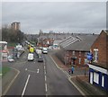
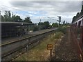
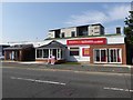
Living in NE11 0UQ offers access to a range of amenities within practical reach. Retail options include Aldi Dunston, Tesco Gateshead, and Heron Durham, providing everyday shopping convenience. The area’s rail network, with stations like Dunston and Metrocentre, connects residents to broader transport systems, while metro services such as Gateshead Stadium and Central Station cater to leisure and commuting needs. A single bus stop at Rhodes Street adds flexibility for local travel. Though the area is small, these amenities contribute to a lifestyle that balances suburban comfort with urban accessibility. The proximity to retail, transport, and public services suggests a practical, community-focused environment, though the limited number of amenities may require trips to nearby areas for more specialised services.
Amenities
Schools
| Rank | School | Type | Entry gender | Ages |
|---|
Explore more schools in this area
Go to Schools tabDemographics
The population of NE11 0UQ is predominantly composed of adults aged 30–64, reflecting a mature demographic with a median age of 47. Home ownership in the area stands at 34%, indicating a mix of owner-occupied and rental properties. The accommodation type is largely houses, which may appeal to families or those seeking more space. The predominant ethnic group is White, though specific data on diversity or deprivation is not provided. This age profile suggests a community with established roots, potentially centred around family life and long-term residency. The lower home ownership rate may reflect a reliance on rental housing or shared living arrangements. The absence of detailed diversity statistics means broader social dynamics remain unexplored, but the data underscores a stable, middle-aged population with a focus on residential stability.
Household Size
Accommodation Type
Tenure
Ethnic Group
Religion
Household Composition
Age
Household Deprivation
NS-SEC
Explore more demographic insights in this area
Go to Demographics tabPlanning
Planning Constraints
- Flood RiskPremium
- Ramsar Wetland SitesPremium
- Area of Outstanding Natural BeautyPremium
- Protected Nature ReservePremium
- Protected WoodlandPremium