Area Overview for NE11 0TH
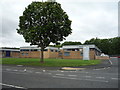
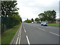
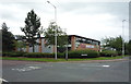
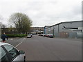
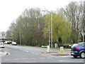
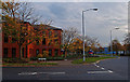
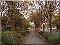
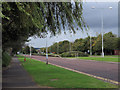
Photos of NE11 0TH
Area Information
NE11 0TH is a small, densely populated residential postcode in England, home to 2018 residents spread across 687 people per square kilometre. This compact area is characterised by its cluster of homes, predominantly occupied by adults aged 30–64, reflecting a mature community. Daily life here is shaped by proximity to transport networks and retail hubs, with residents benefiting from multiple rail and metro links. The area’s compact nature means amenities are within practical reach, though its small size also means it is a niche postcode, ideal for those seeking a focused, community-oriented environment. With a low flood risk and no environmental constraints like protected woodlands or wetlands, the area is free from planning restrictions that might complicate development. However, the high crime risk score of 0/100 underscores the need for caution, particularly for families or individuals prioritising safety. For buyers, NE11 0TH offers a snapshot of suburban living with direct access to key services, though its limited size means it is best suited to those who value convenience over expansive space.
- Area Type
- Postcode
- Area Size
- Not available
- Population
- 2018
- Population Density
- 687 people/km²
NE11 0TH’s property market is defined by its low home ownership rate of 34%, indicating that less than a third of properties are owner-occupied, with the remainder likely in rental or shared ownership. The area’s housing stock is dominated by houses, which may appeal to buyers seeking more space or privacy compared to flats. However, the small postcode size means the available housing stock is limited, potentially restricting choice for buyers. This dynamic suggests a niche market, where properties are likely to be in high demand relative to supply. For those considering purchase, the predominance of houses could mean higher price points and fewer opportunities for investment in rental properties. The area’s compact nature also means buyers must weigh the benefits of proximity to amenities against the constraints of limited housing options.
House Prices in NE11 0TH
No properties found in this postcode.
Energy Efficiency in NE11 0TH
Living in NE11 0TH offers access to a range of amenities within practical reach. Retail options include Sainsburys Team, Asda Living, and M&S Gateshead Team Valley SF, providing essential shopping and dining choices. The area’s proximity to rail stations like Dunston, Heworth, and Metrocentre ensures easy access to larger retail and leisure hubs. Metro stops at Gateshead Stadium and Felling connect residents to sports venues and cultural attractions. While the bus network is limited to a single stop at Rhodes Street, the rail and metro links compensate with frequent services. The combination of retail, transport, and proximity to urban centres creates a lifestyle that balances convenience with connectivity, allowing residents to enjoy both local amenities and broader regional opportunities.
Amenities
Schools
| Rank | School | Type | Entry gender | Ages |
|---|
Explore more schools in this area
Go to Schools tabDemographics
The population of NE11 0TH skews towards adults aged 30–64, with a median age of 47, indicating a community of established professionals and families. Home ownership here is relatively low at 34%, suggesting a mix of owner-occupied properties and rental units. The predominant accommodation type is houses, which aligns with the area’s residential character. The ethnic composition is largely White, reflecting broader regional patterns. While the data does not specify deprivation levels, the age profile and home ownership rate suggest a stable, middle-aged population with established routines. This demographic structure may influence local services and amenities, which are tailored to the needs of working adults and families. The absence of detailed diversity metrics means the community’s social fabric remains largely unexplored in the data, though the focus on houses and adult residents points to a settled, long-term population.
Household Size
Accommodation Type
Tenure
Ethnic Group
Religion
Household Composition
Age
Household Deprivation
NS-SEC
Explore more demographic insights in this area
Go to Demographics tabPlanning
Planning Constraints
- Flood RiskPremium
- Ramsar Wetland SitesPremium
- Area of Outstanding Natural BeautyPremium
- Protected Nature ReservePremium
- Protected WoodlandPremium