Area Overview for NE11 0RH
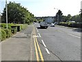
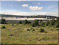
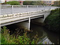
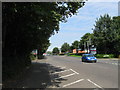
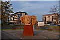
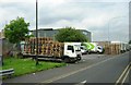
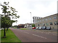
Photos of NE11 0RH
Area Information
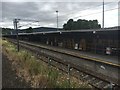
NE11 0RH is a compact residential postcode in England, covering just 3.1 hectares and home to 2018 residents. Its population density of 687 people per square kilometre reflects a tightly knit community, though the area remains small enough to feel intimate. The postcode is characterised by a mix of housing types, with a focus on family homes, and a median age of 47 suggests a stable, mature demographic. Daily life here is shaped by proximity to transport hubs, including five nearby railway stations such as Dunston and Manors, which link residents to broader regional networks. Retail options are limited but functional, with Co-op Low and Heron Durham offering essential services. The area’s digital connectivity is strong, with a broadband score of 97, though mobile coverage is slightly lower at 85. While the environment is free from planning constraints like protected woodlands or wetlands, safety remains a concern. This small cluster offers a quiet, accessible lifestyle for those prioritising convenience over sprawling urban amenities.
- Area Type
- Postcode
- Area Size
- 3.1 hectares
- Population
- 2018
- Population Density
- 687 people/km²
The property market in NE11 0RH is characterised by a low home ownership rate of 34%, suggesting that most residents are either tenants or in shared ownership arrangements. The area’s housing stock is dominated by houses, which may appeal to those seeking more space in a compact setting. Given the small area size of 3.1 hectares, the housing options are limited, and the immediate surroundings likely offer few alternatives. This makes the area attractive for buyers seeking a specific location, though competition for properties may be limited. The predominance of owner-occupied homes is not evident, which could indicate a reliance on rental markets. Buyers should consider the proximity to transport and amenities, which may outweigh the constraints of a small housing stock. The area’s compact nature also means that property values may be influenced more by location-specific factors than broader regional trends.
House Prices in NE11 0RH
No properties found in this postcode.
Energy Efficiency in NE11 0RH
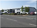
Living in NE11 0RH offers access to a range of amenities within practical reach. Retail options include five shops, such as Co-op Low and Heron Low, providing essentials like groceries and daily necessities. The area’s proximity to railway stations like Dunston and Manors, along with metro services at Gateshead and Central Station, ensures easy access to regional hubs. For leisure, Gateshead Stadium and nearby venues offer recreational opportunities. While dining options are not explicitly listed, the presence of retail and transport hubs suggests a functional, if modest, lifestyle. The compact nature of the area means amenities are concentrated, reducing travel time for essentials. However, the limited number of venues may require residents to venture slightly further for more specialised services. The combination of transport links and basic retail makes NE11 0RH suitable for those prioritising convenience over expansive urban amenities.
Amenities
Schools
| Rank | School | Type | Entry gender | Ages |
|---|
Explore more schools in this area
Go to Schools tabDemographics
The community in NE11 0RH is predominantly composed of adults aged 30–64, with a median age of 47. This suggests a population that is largely established, with fewer young families or retirees. Home ownership is relatively low at 34%, indicating that a significant portion of the housing stock is rented. The area is primarily composed of houses, which contrasts with higher-density housing types. The predominant ethnic group is White, though no specific data on diversity or deprivation is provided. The high population density of 687 people per square kilometre implies a compact, possibly multi-generational living environment. For buyers, this demographic profile may indicate a community with a focus on stability and long-term residency, though the lower home ownership rate could suggest a rental market with limited opportunities for property investment.
Household Size
Accommodation Type
Tenure
Ethnic Group
Religion
Household Composition
Age
Household Deprivation
NS-SEC
Explore more demographic insights in this area
Go to Demographics tabPlanning
Planning Constraints
- Flood RiskPremium
- Ramsar Wetland SitesPremium
- Area of Outstanding Natural BeautyPremium
- Protected Nature ReservePremium
- Protected WoodlandPremium