Area Overview for NE11 0LJ
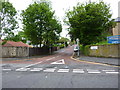
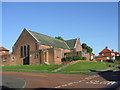
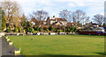
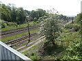
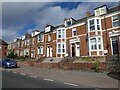
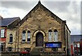
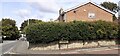
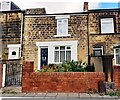
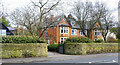
Photos of NE11 0LJ


Area Information
NE11 0LJ is a small residential postcode in England, covering 1492 square metres and home to 2018 residents. With a population density of 687 people per square kilometre, it is a compact area characterised by a mix of housing and proximity to key transport links. The community here skews towards adults aged 30–64, with a median age of 47, suggesting a stable, mature demographic. Daily life in NE11 0LJ balances local amenities with connectivity to larger urban hubs. Residents benefit from nearby retail outlets, rail stations, and metro stops, making it a practical choice for those needing access to both suburban living and city resources. The area’s small size means it is tightly knit, with limited housing stock, which could influence property availability and pricing. While the area lacks natural constraints like protected woodlands or wetlands, its proximity to transport infrastructure and retail options makes it appealing to commuters and those prioritising convenience over expansive green spaces.
- Area Type
- Postcode
- Area Size
- 1492 m²
- Population
- 2018
- Population Density
- 687 people/km²
NE11 0LJ’s property market is defined by a low home ownership rate of 34%, suggesting that the area is more rental-focused than owner-occupied. The accommodation type is predominantly houses, which is unusual for a small postcode area, potentially indicating a mix of older, larger properties or semi-detached homes. This dynamic may make the area attractive to tenants seeking more space than typical flats or apartments. However, the limited size of the postcode—just 1492 square metres—means the housing stock is constrained, which could drive competition among renters. For buyers, the area’s small footprint and rental orientation may mean fewer opportunities for purchase, with properties more likely to be targeted by investors or first-time buyers looking for entry-level homes. Proximity to transport links and retail hubs may offset the area’s limited size, making it a practical choice for those prioritising location over property scale.
House Prices in NE11 0LJ
No properties found in this postcode.
Energy Efficiency in NE11 0LJ
Living in NE11 0LJ offers access to a range of nearby amenities that cater to daily needs. Retail options include Sainsburys Team, Asda Living, and M&S Gateshead Team Valley SF, providing convenience for grocery shopping and general retail. The area is served by five rail stations, including Dunston and Metrocentre, as well as metro stops near Gateshead Stadium and Felling, facilitating easy travel to larger hubs. A single bus route at Rhodes Street adds to local mobility. While the area lacks major parks or leisure facilities, its proximity to transport links and retail hubs ensures residents can access entertainment, dining, and services in nearby towns. The compact layout means amenities are within practical reach, supporting a lifestyle that balances local convenience with broader connectivity.
Amenities
Schools
| Rank | School | Type | Entry gender | Ages |
|---|
Explore more schools in this area
Go to Schools tabDemographics
The population of NE11 0LJ is predominantly adults aged 30–64, with a median age of 47. This suggests a community of established professionals and families, rather than students or retirees. Home ownership rates here are relatively low at 34%, indicating that a majority of residents rent their homes. The accommodation type is primarily houses, which is uncommon in densely populated areas, hinting at a mix of semi-detached or terraced housing. The predominant ethnic group is White, with no specific data on diversity beyond this. The age profile and home ownership figures suggest a community that may prioritise rental flexibility over long-term property investment. The absence of detailed diversity metrics means broader social dynamics remain unexplored, but the demographic profile points to a stable, middle-aged population with established routines and needs.
Household Size
Accommodation Type
Tenure
Ethnic Group
Religion
Household Composition
Age
Household Deprivation
NS-SEC
Explore more demographic insights in this area
Go to Demographics tabPlanning
Planning Constraints
- Flood RiskPremium
- Ramsar Wetland SitesPremium
- Area of Outstanding Natural BeautyPremium
- Protected Nature ReservePremium
- Protected WoodlandPremium