Area Overview for NE11 0LE
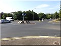
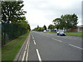
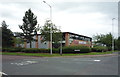
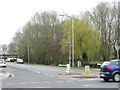
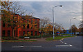
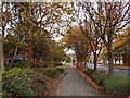
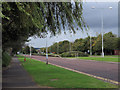
Photos of NE11 0LE


Area Information
NE11 0LE is a compact residential postcode in England, home to 2018 people spread across a densely populated area of 687 people per square kilometre. This small cluster of homes sits at the heart of a practical, everyday living environment, where proximity to amenities and transport networks shapes daily life. The area’s character is defined by its mix of local shops, public transport links, and a community skewed towards middle-aged residents. With a median age of 47 and a majority of adults aged 30–64, the area feels grounded in stability, with a focus on convenience over grandeur. Living here means navigating a tight-knit neighbourhood where local retail, rail, and metro services are within easy reach. While the population density suggests a shared, communal feel, the area’s small size means it is not a sprawling suburb but a tightly woven cluster of homes. For those seeking a balance between urban access and residential calm, NE11 0LE offers a pragmatic base, though its limited size means the surrounding areas are often where broader opportunities lie.
- Area Type
- Postcode
- Area Size
- Not available
- Population
- 2018
- Population Density
- 687 people/km²
The property market in NE11 0LE is characterised by a low home ownership rate of 34%, suggesting that the area is more rental-focused than owner-occupied. The accommodation type is primarily houses, which is notable for a small postcode, indicating a potential mix of older, family-sized homes and perhaps some newer builds. This dynamic implies that the housing stock is limited in scale, with fewer high-density developments. For buyers, this means a smaller pool of properties to choose from, though the focus on houses may appeal to those seeking single-family homes. However, the low home ownership rate could also signal challenges in securing long-term investment opportunities, as the area may be more transient. Given the compact nature of NE11 0LE, buyers should consider the immediate surroundings for broader options, as the local market is unlikely to offer extensive variety. The predominance of houses also suggests that the area may cater to those prioritising space over proximity to city centres, though the nearby transport links could mitigate this.
House Prices in NE11 0LE
No properties found in this postcode.
Energy Efficiency in NE11 0LE
Daily life in NE11 0LE is shaped by its proximity to a range of amenities, from retail to transport hubs. Local shops include M&S Gateshead Team Valley SF, Asda Living, and Sainsburys Team, offering practical shopping options for residents. The area’s rail network is particularly well-served, with Dunston Railway Station, Metrocentre Railway Station, and Heworth Railway Station providing links to nearby destinations. Metro stops at Gateshead Stadium and Felling add to the transport diversity, while a bus route at Rhodes Street ensures local connectivity. These services create a practical, accessible lifestyle, with minimal need to travel far for essentials. The mix of retail, transport, and nearby leisure options suggests a community focused on convenience rather than luxury. While the area’s small size means it lacks sprawling parks or cultural landmarks, its proximity to larger hubs likely compensates, making it a functional base for those prioritising ease of access over expansive amenities.
Amenities
Schools
| Rank | School | Type | Entry gender | Ages |
|---|
Explore more schools in this area
Go to Schools tabDemographics
The community in NE11 0LE is predominantly composed of adults aged 30–64, with a median age of 47. This suggests a population largely in their prime working years, with a strong presence of families and professionals. Home ownership is relatively low at 34%, indicating a higher proportion of renters in the area. The accommodation type is primarily houses, which is unusual for a postcode of this size, hinting at a mix of older properties and perhaps some newer developments. The predominant ethnic group is White, though no further breakdown of diversity is provided. The demographic profile suggests a mature, settled population, likely with established careers and long-term ties to the area. With 687 people per square kilometre, the density supports a mix of local services but may also mean limited space for expansion. This profile aligns with a community that values proximity to amenities over large-scale development, though the low home ownership rate could reflect economic pressures or a preference for renting in a dynamic local market.
Household Size
Accommodation Type
Tenure
Ethnic Group
Religion
Household Composition
Age
Household Deprivation
NS-SEC
Explore more demographic insights in this area
Go to Demographics tabPlanning
Planning Constraints
- Flood RiskPremium
- Ramsar Wetland SitesPremium
- Area of Outstanding Natural BeautyPremium
- Protected Nature ReservePremium
- Protected WoodlandPremium