Area Overview for NE10 8PN
Photos of NE10 8PN


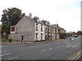


53 photos from this area
Area Information
Key information about the NE10 8PN including its size, population, and administrative classification.
- Area Type
- Postcode
- Area Size
- 1.5 hectares
- Population
- 1609
- Population Density
- 5114 people/km²
House Prices in NE10 8PN
41
Properties
£114,369
Average Sold Price
£40,950
Lowest Price
£338,400
Highest Price
Showing 41 properties
| Address | Type | Beds | Baths | Last Sale Price | Last Sale Date | |
|---|---|---|---|---|---|---|
| Residential Accommodation, The Deuchar Arms, Colegate, Leam Lane Estate, Felling, NE10 8PN | Flat | - | - | £338,400 | Apr 2024 | |
| 28 Colegate, Leam Lane Estate, Felling, NE10 8PN | house | 2 | 1 | £130,000 | Jul 2022 | |
| 26 Colegate, Leam Lane Estate, Felling, NE10 8PN | Semi-detached | 2 | - | £122,000 | Mar 2022 | |
| 9 Colegate, Leam Lane Estate, Felling, NE10 8PN | house | - | - | £132,500 | Jan 2022 | |
| 33 Colegate, Leam Lane Estate, Felling, NE10 8PN | house | - | - | £116,950 | Dec 2021 | |
| 37 Colegate, Leam Lane Estate, Felling, NE10 8PN | house | - | - | £82,000 | Nov 2019 | |
| 8 Colegate, Leam Lane Estate, Felling, NE10 8PN | house | - | - | £76,000 | Mar 2019 | |
| 35 Colegate, Leam Lane Estate, Felling, NE10 8PN | Semi-detached | 2 | 1 | £113,000 | Jun 2017 | |
| 11 Colegate, Leam Lane Estate, Felling, NE10 8PN | Semi-detached | 2 | 1 | £104,000 | Apr 2017 | |
| 2 Colegate, Leam Lane Estate, Felling, NE10 8PN | house | - | - | £70,000 | Oct 2015 |
Page 1 of 5
Energy Efficiency in NE10 8PN
Amenities
Schools
| Rank | School | Type | Entry gender | Ages |
|---|
Explore more schools in this area
Go to Schools tabDemographics
Household Size
Family (3-5 people)
most common
Accommodation Type
Houses
most common
Tenure
47
majority
Ethnic Group
White
most common
Religion
N/A
most common
Household Composition
N/A
most common
Age
47
median
Adults (30-64 years)
most common
Household Deprivation
N/A
with no deprivation
NS-SEC
18
in Lower managerial occupations
Explore more demographic insights in this area
Go to Demographics tabPlanning
Planning Constraints
- Flood RiskPremium
- Ramsar Wetland SitesPremium
- Area of Outstanding Natural BeautyPremium
- Protected Nature ReservePremium
- Protected WoodlandPremium