Area Overview for NE10 0WP
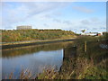
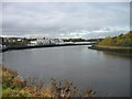
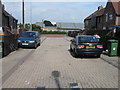
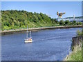
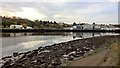
Photos of NE10 0WP


Area Information
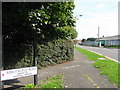
NE10 0WP is a small residential postcode in England, home to 1,852 people. It forms a tight-knit cluster of properties, offering a quiet, community-focused lifestyle. The area’s compact nature means residents are close to local amenities, schools, and transport links. Daily life here is shaped by proximity to retail hubs, rail networks, and nearby leisure facilities. With a median age of 47, the population skews towards adults in their 30s to 60s, suggesting a stable, established community. While the area lacks high-density development, its low flood risk and absence of environmental restrictions make it a practical choice for buyers seeking a balance between convenience and safety. The postcode’s limited size means it is best suited for those prioritising ease of access to nearby towns and services over expansive open spaces. For homebuyers, NE10 0WP represents a blend of simplicity and connectivity, with a focus on functional living over grandeur.
- Area Type
- Postcode
- Area Size
- Not available
- Population
- 1852
- Population Density
- 2051 people/km²
NE10 0WP’s property market is defined by a 49% home ownership rate, indicating that nearly half of properties are rented. This suggests a rental market that may cater to both long-term tenants and short-term lettings. The accommodation type is predominantly houses, which is unusual for a small postcode and may reflect a mix of older, larger properties and newer builds. The presence of houses rather than flats implies a focus on family-friendly living, with potential for larger living spaces. However, the low population density and limited area size mean the market is niche, with limited scope for expansion. Buyers should consider the area’s compact nature and its reliance on nearby towns for services. For those seeking a home with garden space and a quieter lifestyle, NE10 0WP may offer opportunities, but its small footprint limits the range of properties available.
House Prices in NE10 0WP
No properties found in this postcode.
Energy Efficiency in NE10 0WP
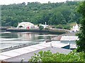
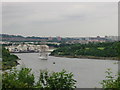
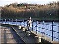
Residents of NE10 0WP benefit from a range of nearby amenities. Retail options include major supermarkets like Lidl, Aldi, and Asda, ensuring everyday shopping needs are met. The area’s rail and metro links, such as Pelaw and Felling stations, connect to larger hubs, while ferry terminals at Newcastle and South Shields offer water-based travel options. For leisure, the Gateshead Stadium and surrounding areas provide recreational opportunities. The presence of multiple retail and transport nodes within walking or short driving distance enhances convenience. The postcode’s compact size means amenities are not spread thin, but the lack of detailed data on parks or dining venues leaves some aspects of lifestyle unexplored. Nonetheless, the mix of retail, transport, and leisure facilities suggests a functional, practical lifestyle tailored to those prioritising accessibility over sprawling urban amenities.
Amenities
Schools
Residents of NE10 0WP have access to two primary schools: St Alban’s Catholic Primary School and St Alban’s Catholic Primary School, Pelaw. Both are primary institutions, though no Ofsted ratings are provided in the data. The presence of two primary schools within the area suggests a focus on early education, likely serving local families with young children. The duplication of names may indicate separate campuses or distinct catchment areas, though the data does not clarify this. For families prioritising proximity to schools, the availability of two primary options is a practical advantage. However, the absence of secondary schools or additional educational facilities means parents may need to look beyond NE10 0WP for comprehensive schooling. The schools’ religious affiliation may also influence their community character, though this is not specified in the data.
| Rank | School | Type | Entry gender | Ages |
|---|
Explore more schools in this area
Go to Schools tabDemographics
The population of NE10 0WP is predominantly adults aged 30–64, with a median age of 47. This suggests a mature, settled community, likely with a mix of working professionals and families. Home ownership stands at 49%, indicating a slight majority of renters, which may reflect the area’s affordability or rental market dynamics. The accommodation type is primarily houses, a rarity in many urban areas, implying a more suburban or semi-rural character. The predominant ethnic group is White, with no data provided on other demographics. The absence of deprivation metrics in the data means the area’s quality of life remains unquantified, though the low flood risk and lack of environmental constraints suggest minimal barriers to living here. The demographic profile aligns with a community focused on stability, with limited evidence of transient or younger populations.
Household Size
Accommodation Type
Tenure
Ethnic Group
Religion
Household Composition
Age
Household Deprivation
NS-SEC
Explore more demographic insights in this area
Go to Demographics tabPlanning
Planning Constraints
- Flood RiskPremium
- Ramsar Wetland SitesPremium
- Area of Outstanding Natural BeautyPremium
- Protected Nature ReservePremium
- Protected WoodlandPremium