Area Overview for NE10 0TJ
Photos of NE10 0TJ


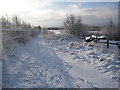


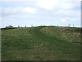

28 photos from this area
Area Information
Key information about the NE10 0TJ including its size, population, and administrative classification.
- Area Type
- Postcode
- Area Size
- 21.2 hectares
- Population
- 1507
- Population Density
- 1498 people/km²
House Prices in NE10 0TJ
83
Properties
£156,626
Average Sold Price
£54,000
Lowest Price
£225,000
Highest Price
Showing 83 properties
| Address | Type | Beds | Baths | Last Sale Price | Last Sale Date | |
|---|---|---|---|---|---|---|
| 21 Marian Drive, Bill Quay, Felling, NE10 0TJ | Bungalow | - | - | £225,000 | Jun 2024 | |
| 148 Marian Drive, Bill Quay, Felling, NE10 0TJ | house | - | - | £180,000 | Jan 2024 | |
| 11 Marian Drive, Bill Quay, Felling, NE10 0TJ | Bungalow | 2 | - | £170,000 | Jan 2024 | |
| 158 Marian Drive, Bill Quay, Felling, NE10 0TJ | house | - | - | £140,000 | Mar 2022 | |
| 29 Marian Drive, Bill Quay, Felling, NE10 0TJ | Bungalow | - | - | £220,000 | Feb 2022 | |
| 150 Marian Drive, Bill Quay, Felling, NE10 0TJ | Semi-detached | 3 | 1 | £220,000 | Sep 2021 | |
| 23 Marian Drive, Bill Quay, Felling, NE10 0TJ | Bungalow | 2 | 1 | £190,000 | Jun 2021 | |
| 37 Marian Drive, Bill Quay, Felling, NE10 0TJ | Semi-detached | 3 | 1 | £206,100 | Nov 2020 | |
| 62 Marian Drive, Bill Quay, Felling, NE10 0TJ | house | 3 | 1 | £190,000 | May 2020 | |
| 136 Marian Drive, Bill Quay, Felling, NE10 0TJ | Semi-detached | 4 | 2 | £223,000 | Nov 2019 |
Page 1 of 9
Energy Efficiency in NE10 0TJ
Amenities
Schools
| Rank | School | Type | Entry gender | Ages |
|---|
Explore more schools in this area
Go to Schools tabDemographics
Household Size
Two person
most common
Accommodation Type
Houses
most common
Tenure
72
majority
Ethnic Group
White
most common
Religion
N/A
most common
Household Composition
N/A
most common
Age
47
median
Adults (30-64 years)
most common
Household Deprivation
N/A
with no deprivation
NS-SEC
34
in Lower managerial occupations
Explore more demographic insights in this area
Go to Demographics tabPlanning
Planning Constraints
- Flood RiskPremium
- Ramsar Wetland SitesPremium
- Area of Outstanding Natural BeautyPremium
- Protected Nature ReservePremium
- Protected WoodlandPremium