Area Overview for NE10 0SS
Photos of NE10 0SS
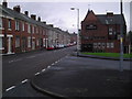
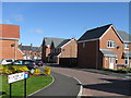
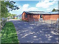
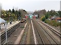
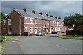
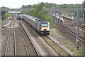
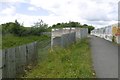

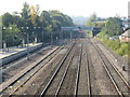
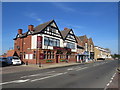
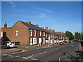

100 photos from this area
Area Information
Key information about the NE10 0SS including its size, population, and administrative classification.
- Area Type
- Postcode
- Area Size
- 3356 m²
- Population
- 1507
- Population Density
- 1498 people/km²
House Prices in NE10 0SS
18
Properties
£97,550
Average Sold Price
£33,000
Lowest Price
£123,000
Highest Price
Showing 18 properties
| Address | Type | Beds | Baths | Last Sale Price | Last Sale Date | |
|---|---|---|---|---|---|---|
| 15 Wellfield Terrace, Bill Quay, Felling, NE10 0SS | Flat | 2 | 1 | £115,000 | Aug 2025 | |
| 13 Wellfield Terrace, Bill Quay, Felling, NE10 0SS | Flat | - | - | £70,000 | Jul 2019 | |
| 11 Wellfield Terrace, Bill Quay, Felling, NE10 0SS | Flat | - | - | £96,000 | Dec 2017 | |
| 1 Wellfield Terrace, Bill Quay, Felling, NE10 0SS | Flat | - | - | £103,000 | Nov 2017 | |
| 2 Wellfield Terrace, Bill Quay, Felling, NE10 0SS | Flat | - | - | £108,950 | Dec 2014 | |
| 5 Wellfield Terrace, Bill Quay, Felling, NE10 0SS | Terraced | - | - | £120,000 | Dec 2009 | |
| 8 Wellfield Terrace, Bill Quay, Felling, NE10 0SS | Maisonette | 4 | 1 | £123,000 | Aug 2007 | |
| 19 Wellfield Terrace, Bill Quay, Felling, NE10 0SS | Flat | - | - | £109,000 | Aug 2007 | |
| 18 Wellfield Terrace, Bill Quay, Felling, NE10 0SS | Flat | - | - | £33,000 | May 1997 | |
| 10 Wellfield Terrace, Bill Quay, Felling, NE10 0SS | Flat | - | - | - | - |
Page 1 of 2
Energy Efficiency in NE10 0SS
Amenities
Schools
| Rank | School | Type | Entry gender | Ages |
|---|
Explore more schools in this area
Go to Schools tabDemographics
Household Size
Two person
most common
Accommodation Type
Houses
most common
Tenure
72
majority
Ethnic Group
White
most common
Religion
N/A
most common
Household Composition
N/A
most common
Age
47
median
Adults (30-64 years)
most common
Household Deprivation
N/A
with no deprivation
NS-SEC
34
in Lower managerial occupations
Explore more demographic insights in this area
Go to Demographics tabPlanning
Planning Constraints
- Flood RiskPremium
- Ramsar Wetland SitesPremium
- Area of Outstanding Natural BeautyPremium
- Protected Nature ReservePremium
- Protected WoodlandPremium