Area Overview for NE10 0ES
Photos of NE10 0ES
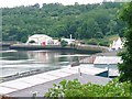
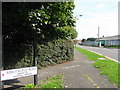

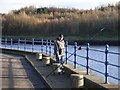
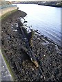

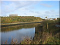
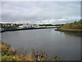
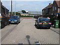


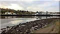
63 photos from this area
Area Information
Key information about the NE10 0ES including its size, population, and administrative classification.
- Area Type
- Postcode
- Area Size
- 22.9 hectares
- Population
- 1532
- Population Density
- 1371 people/km²
House Prices in NE10 0ES
6
Properties
-
Average Sold Price
-
Lowest Price
-
Highest Price
Showing 6 properties
| Address | Type | Beds | Baths | Last Sale Price | Last Sale Date | |
|---|---|---|---|---|---|---|
| Cromadex, Nest Road, Felling Central, Felling, NE10 0ES | storage_distribution | - | - | - | - | |
| Tdg Uk Storage, Nest Road, Felling Central, Felling, NE10 0ES | commercial | - | - | - | - | |
| Jtl Scaffolding Ltd, Jtl, Nest Road, Felling Central, Felling, NE10 0ES | office_workshop | - | - | - | - | |
| Global M T P Uk Services, Land And Buildings, Nest Road, Felling Central, Felling, NE10 0ES | warehouse | - | - | - | - | |
| Bentincks Ltd, Nest Road, Felling Central, Felling, NE10 0ES | general_industrial | - | - | - | - | |
| Loomis Uk Ltd, Nest Road, Felling Central, Felling, NE10 0ES | commercial | - | - | - | - |
Energy Efficiency in NE10 0ES
Amenities
Schools
| Rank | School | Type | Entry gender | Ages |
|---|
Explore more schools in this area
Go to Schools tabDemographics
Household Size
One person
most common
Accommodation Type
Houses
most common
Tenure
24
majority
Ethnic Group
White
most common
Religion
N/A
most common
Household Composition
N/A
most common
Age
47
median
Adults (30-64 years)
most common
Household Deprivation
N/A
with no deprivation
NS-SEC
18
in Lower managerial occupations
Explore more demographic insights in this area
Go to Demographics tabPlanning
Planning Constraints
- Flood RiskPremium
- Ramsar Wetland SitesPremium
- Area of Outstanding Natural BeautyPremium
- Protected Nature ReservePremium
- Protected WoodlandPremium