Area Overview for NE10 0EP
Photos of NE10 0EP


Area Information
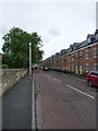
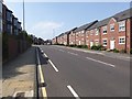
NE10 0EP is a small residential postcode area in England, home to 1776 people. It is a compact cluster of properties, likely centred around a mix of housing types, though the data specifies that houses are the predominant accommodation. The area’s modest size means it is likely to feel tight-knit, with residents having limited immediate space but potentially strong local connections. Daily life here is shaped by its proximity to transport hubs and retail centres. The population is skewed towards adults aged 30–64, suggesting a community of working-age individuals and families. With 18% home ownership, the area is mostly rental-based, which may influence the character of the neighbourhood. Residents are likely to rely on nearby amenities, including schools, public transport, and retail outlets, which are within practical reach. The low flood risk and absence of protected natural sites indicate a relatively stable environment, though crime rates are notably high. For buyers, the area offers a specific, limited footprint with clear access to essential services, though the small population and high crime score may raise questions about long-term viability.
- Area Type
- Postcode
- Area Size
- Not available
- Population
- 1776
- Population Density
- 2568 people/km²
The property market in NE10 0EP is characterised by a low home ownership rate of 18%, indicating that the area is primarily a rental market. Despite this, the accommodation type is predominantly houses, which is atypical for a small postcode area. This suggests a niche market where larger properties are available, potentially catering to families or individuals seeking more space. The limited population and small footprint mean that the housing stock is likely constrained, with fewer options for buyers. For those considering purchase, the area’s rental focus may mean competition is high, and properties could be in demand from tenants looking for long-term stability. However, the high crime risk score of 10 may deter some buyers, particularly those prioritising safety. The presence of houses rather than flats or apartments also implies that the area may not be ideal for investors seeking high-density housing.
House Prices in NE10 0EP
No properties found in this postcode.
Energy Efficiency in NE10 0EP
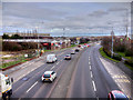
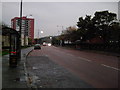
The lifestyle in NE10 0EP is shaped by its proximity to a range of amenities. Retail options include five outlets such as Asda Gateshead and Aldi Central, offering everyday shopping convenience. The area’s metro sites, like Gateshead Stadium and Felling, suggest access to sports and leisure facilities, while rail stations at Heworth, Manors, and Dunston provide commuting routes. A single bus stop at Rhodes Street and two ferry terminals—Newcastle International and South Shields—add to the transport diversity, enabling travel to coastal or urban destinations. Though the data does not specify parks or recreational spaces, the absence of protected natural sites may indicate limited green areas. The presence of schools, retail, and transport hubs suggests a functional, if modest, lifestyle. Residents can enjoy a mix of urban and commuter-focused amenities, though the small area’s footprint may limit the variety of venues available for social or cultural activities.
Amenities
Schools
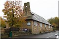
Residents of NE10 0EP have access to two primary schools: St Wilfrid’s Roman Catholic Voluntary Aided Primary School and St Wilfrid’s Catholic Primary School, Gateshead. Both are primary institutions, though no Ofsted ratings are provided in the data. The presence of two schools within the area suggests a focus on local education, which may be beneficial for families with young children. However, the absence of secondary schools or further education institutions means residents may need to travel to nearby areas for higher-level schooling. The dual Catholic schools indicate a specific religious affiliation within the community, which could influence the social and cultural environment. For families prioritising proximity to schools, the availability of two primary options is a positive, but the lack of diversity in school types may limit choices.
| Rank | School | Type | Entry gender | Ages |
|---|
Explore more schools in this area
Go to Schools tabDemographics
The population of NE10 0EP is 1776, with a median age of 47, reflecting a mature demographic. The majority of residents fall within the 30–64 age range, indicating a community of working-age adults and families. Home ownership is low at 18%, meaning most residents are likely to be renting. The accommodation type is predominantly houses, which is unusual for a small area, suggesting a focus on family homes or larger properties. The predominant ethnic group is White, though no further breakdown of diversity is provided. The absence of specific data on deprivation or income levels means it is unclear how this affects quality of life, but the high crime score of 10 (out of 100) raises concerns about safety. This score places the area in the highest risk category for crime, which could influence daily routines and perceptions of security. The combination of older residents, rental-focused housing, and high crime rates paints a picture of a community that may prioritise stability over growth.
Household Size
Accommodation Type
Tenure
Ethnic Group
Religion
Household Composition
Age
Household Deprivation
NS-SEC
Explore more demographic insights in this area
Go to Demographics tabPlanning
Planning Constraints
- Flood RiskPremium
- Ramsar Wetland SitesPremium
- Area of Outstanding Natural BeautyPremium
- Protected Nature ReservePremium
- Protected WoodlandPremium