Area Overview for NE1 8ST
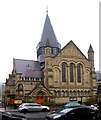
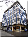
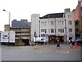
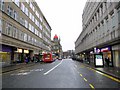
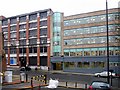
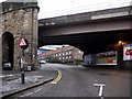
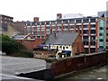
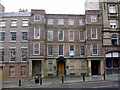
Photos of NE1 8ST


Area Information
NE1 8ST is a compact residential postcode in England, covering just 2.3 hectares and home to 2,796 residents. Its small size means it’s a tightly knit area, with a population density of 2,036 people per square kilometre. This is a young community, with a median age of 22 and the majority of residents aged 15–29. The area is dominated by flats, with only 11% of homes owned outright, suggesting a rental-heavy market. Proximity to the University of Newcastle Upon Tyne and the University of Northumbria At Newcastle makes it a popular spot for students and young professionals. Despite its urban setting, NE1 8ST has minimal environmental constraints, with no protected woodlands, AONBs, or Ramsar sites nearby. However, crime risk is high, with a safety score of 0/100, which residents should factor into their decision. The area’s compact nature means amenities are within walking distance, but broadband connectivity is poor, scoring 41 out of 100. For those prioritising convenience and proximity to higher education, NE1 8ST offers a distinct blend of urban accessibility and youthful energy.
- Area Type
- Postcode
- Area Size
- 2.3 hectares
- Population
- 2796
- Population Density
- 2036 people/km²
NE1 8ST is a rental-dominated area, with only 11% of homes owned by residents. The accommodation type is exclusively flats, which aligns with the needs of a young, transient population, particularly students and those working in higher education. This suggests a market tailored to short-term stays rather than long-term family homes. The small area size means housing stock is limited, and property availability is likely constrained by the high population density. For buyers, this presents challenges: with minimal owner-occupied properties, the area is not ideal for those seeking a permanent residence. Instead, it may appeal to investors looking to capitalise on the rental demand driven by nearby universities. However, the high crime risk and poor broadband connectivity could deter buyers prioritising security and digital infrastructure.
House Prices in NE1 8ST
Showing 13 properties
Energy Efficiency in NE1 8ST
NE1 8ST offers a range of amenities within easy reach, including five retail outlets such as Tesco Newcastle and Sainsburys Newcastle, ensuring everyday shopping needs are met. The metro, rail, and bus networks provide seamless access to the city’s core, while proximity to Newcastle Airport adds convenience for travel. The area’s compact nature means residents can access these facilities without long commutes. However, the lack of named parks or leisure facilities in the data suggests limited green space for recreation. The presence of multiple transport hubs and retail options contributes to a practical, urban lifestyle, ideal for those prioritising accessibility over expansive outdoor amenities. Daily life here is fast-paced, shaped by the proximity to universities and the density of services.
Amenities
Schools
The nearest educational institutions to NE1 8ST are the University of Newcastle Upon Tyne and the University of Northumbria At Newcastle, both classified as ‘other’ in the data. These are higher education establishments, not primary or secondary schools, meaning families with younger children may need to look further afield for schools. The absence of listed K–12 schools in the data suggests that the area is not designed for families requiring immediate access to local education. Residents with school-age children might find themselves relying on nearby districts or commuting to other parts of Newcastle for primary or secondary schooling. This dynamic highlights that while NE1 8ST is convenient for university students, it may not be the best fit for those prioritising proximity to schools for younger children.
| Rank | School | Type | Entry gender | Ages |
|---|
Explore more schools in this area
Go to Schools tabDemographics
The population of NE1 8ST is overwhelmingly young, with a median age of 22 and 64% of residents falling within the 15–29 age bracket. This reflects a community shaped by students and early-career professionals, with 11% of homes owned by residents and the remaining 89% likely to be rented. The area is dominated by flats, which account for all accommodation types listed, suggesting a focus on affordable, short-term housing. The predominant ethnic group is White, though specific diversity metrics are not provided. With a population density of 2,036 people per square kilometre, the area is densely populated, which can influence the pace of daily life. The high proportion of young adults also means the community is dynamic, with a focus on social and educational pursuits. However, the low home ownership rate indicates limited long-term investment in property, which may affect the area’s stability over time.
Household Size
Accommodation Type
Tenure
Ethnic Group
Religion
Household Composition
Age
Household Deprivation
NS-SEC
Explore more demographic insights in this area
Go to Demographics tabPlanning
Planning Constraints
- Flood RiskPremium
- Ramsar Wetland SitesPremium
- Area of Outstanding Natural BeautyPremium
- Protected Nature ReservePremium
- Protected WoodlandPremium