Area Overview for NE1 8SB
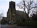
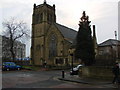
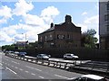
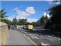
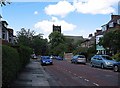
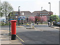
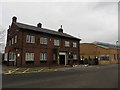
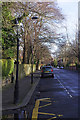
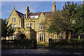
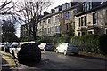
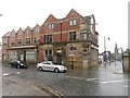
Photos of NE1 8SB

Area Information
Living in NE1 8SB means inhabiting a compact residential cluster in northeast England, where 2,796 people reside across 1.1 hectares. This area is defined by its proximity to two major universities—the University of Newcastle Upon Tyne and the University of Northumbria At Newcastle—making it a hub for students and young professionals. The population density of 2,036 people per square kilometre reflects a tightly packed community, with the majority of residents aged 15–29. Daily life here is shaped by the availability of nearby transport links, including rail stations like Manors and Metrocentre, and the convenience of major supermarkets such as Co-op Newcastle. However, the area’s high crime risk score—0/100—means residents should consider enhanced security measures. Despite this, NE1 8SB offers a compact, accessible environment with easy access to educational institutions and urban amenities, though its small size means the housing market is limited to a few flats. For those seeking a dynamic, student-oriented lifestyle, this postcode’s proximity to universities and transport networks is a key draw.
- Area Type
- Postcode
- Area Size
- 1.1 hectares
- Population
- 2796
- Population Density
- 2036 people/km²
The property market in NE1 8SB is overwhelmingly rental-focused, with just 11% of residents owning their homes. The accommodation type is almost exclusively flats, reflecting the area’s small size and high population density. This suggests a limited housing stock, with most properties being smaller, purpose-built units suited to students or short-term tenants. The lack of owner-occupied homes indicates that the market is not geared towards long-term buyers seeking family homes or investment properties. For those considering NE1 8SB, the scarcity of flats for sale means competition is likely fierce, and options are restricted to a narrow range of units. The area’s proximity to universities may explain this trend, as demand is driven by transient populations rather than permanent residents. Buyers should approach the market with realistic expectations, focusing on rental opportunities rather than ownership.
House Prices in NE1 8SB
Showing 1 properties
| Address | Type | Beds | Baths | Last Sale Price | Last Sale Date | |
|---|---|---|---|---|---|---|
| Northumbria University, Students Union, Sandyford Road, Newcastle Upon Tyne, NE1 8SB | assembly_leisure | - | - | - | - |
Energy Efficiency in NE1 8SB
Life in NE1 8SB is characterised by convenience and accessibility, with a range of amenities within reach. Retail options include major supermarkets like Co-op Newcastle and Sainsburys Newcastle, alongside smaller stores such as Spar Sandyford. The area’s proximity to metro stations like Jesmond and Haymarket, plus rail links to Manors and Metrocentre, ensures easy access to shopping, dining, and leisure in Newcastle’s city centre. The nearby Newcastle Airport adds to the area’s connectivity, facilitating travel. While parks and green spaces are not explicitly mentioned in the data, the lack of protected natural areas suggests a focus on urban living. The mix of retail, transport, and proximity to universities creates a dynamic environment, though the small size of the area means amenities are concentrated rather than spread out.
Amenities
Schools
NE1 8SB is within reach of two major universities: the University of Newcastle Upon Tyne and the University of Northumbria At Newcastle. These institutions contribute to the area’s student-centric character, though no primary or secondary schools are listed in the data. For families requiring local education, this means the area may not be ideal for those prioritising schools for younger children. The absence of primary schools nearby suggests that residents must rely on nearby districts for schooling, potentially increasing commuting times. However, the presence of two universities offers opportunities for higher education and related employment, making NE1 8SB attractive to students and academics. The mix of educational institutions highlights the area’s role as a hub for tertiary education rather than a family-oriented community.
| Rank | School | Type | Entry gender | Ages |
|---|
Explore more schools in this area
Go to Schools tabDemographics
NE1 8SB has a median age of 22, with the most common age range being 15–29 years. This reflects a community dominated by young adults, likely students or recent graduates drawn to the nearby universities. Only 11% of residents own their homes, with flats being the predominant accommodation type. This suggests a rental market skewed towards temporary stays, possibly linked to the area’s student population. The predominant ethnic group is White, though specific data on other demographics is not provided. The high proportion of young residents and low home ownership rate indicate a transient community, with limited long-term residential stability. This profile shapes the area’s character, prioritising short-term housing needs over family-oriented living. For buyers, this means the market is unlikely to cater to those seeking owner-occupied properties or larger homes.
Household Size
Accommodation Type
Tenure
Ethnic Group
Religion
Household Composition
Age
Household Deprivation
NS-SEC
Explore more demographic insights in this area
Go to Demographics tabPlanning
Planning Constraints
- Flood RiskPremium
- Ramsar Wetland SitesPremium
- Area of Outstanding Natural BeautyPremium
- Protected Nature ReservePremium
- Protected WoodlandPremium