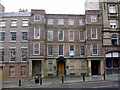
Area Overview for NE1 6NJ
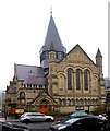
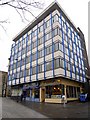
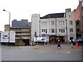
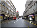
Photos of NE1 6NJ


Area Information
NE1 6NJ is a compact postcode area in England, covering just 875 square metres and home to 2,986 residents. Its high population density—over 3.4 million people per square kilometre—reflects a tightly packed residential cluster, typical of urban settings. The area’s character is defined by its proximity to transport hubs and retail amenities, with Sainsburys Newcastle, Tesco Newcastle Upon, and Tesco Stoddard within easy reach. Daily life here is shaped by its youthful demographic, with 22-year-olds forming the median age and young adults (15–29) making up the majority of the population. This suggests a community skewed toward students, recent graduates, or those working in nearby industries. The area’s small size means amenities and services are closely grouped, with multiple railway stations—including Manors, Heworth, and Dunston—offering connections to Newcastle’s metro system. While the postcode lacks natural landscapes or protected areas, its strategic location near Newcastle Airport and the International Ferry Terminal ensures strong regional connectivity. Living in NE1 6NJ offers a blend of urban convenience and practical accessibility, though its density and limited green space may appeal more to those prioritising proximity to services over spacious living.
- Area Type
- Postcode
- Area Size
- 875 m²
- Population
- 2986
- Population Density
- 12158 people/km²
NE1 6NJ’s property market is dominated by rental flats, with just 11% of homes owner-occupied. This suggests the area functions as a secondary market for tenants rather than a primary destination for buyers seeking long-term residence. The high population density and small area size mean housing stock is limited to multi-unit developments, with flats being the sole accommodation type. For prospective buyers, this implies limited availability of standalone homes and a focus on shared or leasehold properties. The low home ownership rate may reflect the area’s appeal to students or workers requiring short-term housing, or its proximity to institutions that prioritise rental accommodation. Buyers should consider the practicality of purchasing in a market where property is predominantly rented, potentially affecting long-term value retention. The immediate surroundings may offer more varied options, but within NE1 6NJ itself, the housing landscape is tightly defined by its compact footprint and rental orientation.
House Prices in NE1 6NJ
Showing 1 properties
| Address | Type | Beds | Baths | Last Sale Price | Last Sale Date | |
|---|---|---|---|---|---|---|
| Martin Tait Redheads, Buxton House, 1 Buxton Street, Newcastle Upon Tyne, NE1 6NJ | office_workshop | - | - | - | - |
Energy Efficiency in NE1 6NJ
Living in NE1 6NJ grants access to a range of retail and transport amenities within short distances. Major supermarkets like Sainsburys Newcastle, Tesco Newcastle Upon, and Tesco Stoddard provide essential shopping options, while the area’s proximity to railway stations—Manors, Heworth, and Dunston—ensures easy access to the metro system. The nearby Monument, Haymarket, and Central Station metro stops further enhance mobility, connecting residents to Newcastle’s broader network. For travel beyond the city, Newcastle Airport and the International Ferry Terminal are within practical reach, offering both domestic and international travel options. The area’s compact nature means amenities are closely grouped, reducing the need for long commutes. While there is no mention of parks or leisure facilities in the data, the density of retail and transport hubs suggests a lifestyle focused on convenience and accessibility. This makes NE1 6NJ ideal for those prioritising proximity to services over expansive green spaces.
Amenities
Schools
| Rank | School | Type | Entry gender | Ages |
|---|
Explore more schools in this area
Go to Schools tabDemographics
The population of NE1 6NJ is overwhelmingly young, with a median age of 22 and 85% of residents falling within the 15–29 age range. This suggests a community dominated by students, young professionals, or those in early career stages. Home ownership is exceptionally low, with only 11% of properties owner-occupied, indicating that the area functions primarily as a rental market. The accommodation type is almost entirely flats, reflecting a preference for compact, shared living spaces in a high-density environment. The predominant ethnic group is White, though no specific data on diversity or deprivation is provided. The age profile and low home ownership imply a transient population, likely influenced by nearby educational institutions or employment opportunities. For buyers, this demographic dynamic means the area may cater more to short-term stays or investment in rental properties than long-term family homes. The lack of data on household composition or income levels means broader quality-of-life implications remain unquantified.
Household Size
Accommodation Type
Tenure
Ethnic Group
Religion
Household Composition
Age
Household Deprivation
NS-SEC
Explore more demographic insights in this area
Go to Demographics tabPlanning
Planning Constraints
- Flood RiskPremium
- Ramsar Wetland SitesPremium
- Area of Outstanding Natural BeautyPremium
- Protected Nature ReservePremium
- Protected WoodlandPremium