Area Overview for Mowden Ward
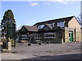
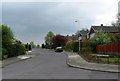
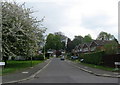
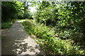
Photos of Mowden Ward

Area Information
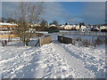
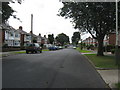
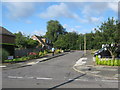
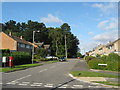
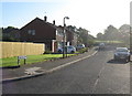
Living in Mowden Ward offers a distinct experience within England, characterised by its compact size and mature residential atmosphere. This district borough unitary ward covers just 1.0 km², creating a very small but defined community where neighbours often know one another. The area is notable for its established feel, driven by a demographic profile that skews heavily towards older residents. You will find that the population centre is significantly older than the national average, with a median age of 70 years. This statistic shapes the daily rhythm of the neighbourhood, suggesting a quieter environment dominated by retirees and long-term residents rather than young families or students. The housing landscape in Mowden Ward reflects this demographic reality, with high levels of stability and established tenure. Most homes in this minimal area are occupied by owners who have settled in their properties for decades. The short geographical footprint means daily errands are contained within a walkable distance, removing the need for extensive commuting from central properties to local amenities. While the area lacks large-scale commercial hubs, its compact nature ensures that residents spend most of their time within a tight-knit community sphere. For anyone considering homes in Mowden Ward, the primary appeal lies in this sense of enclosure and the mature, low-traffic setting that defines life in this small sector.
- Area Type
- District Borough Unitary Ward
- Area Size
- 1.0 km²
- Population
- Not available
- Population Density
- Not available
Demographics
The community in Mowden Ward is defined by its elderly population and exceptional rate of home ownership. You will encounter very few young people, as the median age stands at 70 years, making it one of the most mature wards in England. This age profile means that schools near Mowden Ward attract a different kind of local engagement, and the general social scene revolves around leisure and retirement rather than raising children. The most common age range covers the total population, confirming that the entire ward is heavily weighted towards this older demographic. Stability is the hallmark of household composition, with 87 per cent of residents owning their homes outright or with a mortgage. This high ownership figure suggests a quiet neighbourhood where people are committed to their addresses for the long term. The low rate of renting indicates that the area is not a student hub or a commuter corridor for young professionals seeking shared accommodation. Instead, you will find traditional family homes or retirement properties that have remained in the same hands for generations. There is little data on predominant ethnic groups or religion in the available records, but the clear ownership and age statistics paint a picture of a settled, private community where financial independence is the norm. For those living in Mowden Ward, this translates to a predictable social environment with strong local ties.
Household Size
Accommodation Type
Tenure
Ethnic Group
Religion
Household Composition
Age
Household Deprivation
NS-SEC
Explore more demographic insights in this area
Go to Demographics tabPlanning
Planning Constraints
- Flood RiskPremium
- Ramsar Wetland SitesPremium
- Area of Outstanding Natural BeautyPremium
- Protected Nature ReservePremium
- Protected WoodlandPremium