Area Overview for Morton Tinmouth
Photos of Morton Tinmouth

Area Information
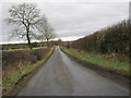
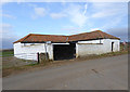
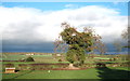
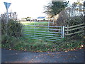
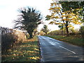
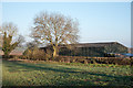
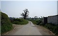
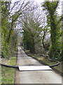
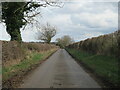
Living in Morton Tinmouth offers a distinctly rural experience within a compact civil parish that covers just 1.7 square kilometres. This small settlement sits near Howick in Northumberland, providing a quiet backdrop for those seeking to escape the faster pace of city living while remaining close to the scenic wider region. The area is defined by its scale and location rather than a dense urban grid or extensive town centre. You will find a community where daily life moves at a considered rhythm, highlighted by the fact that the median age of residents stands at 70 years. This demographic profile suggests a neighbourhood primarily populated by retirees and long-term residents who value stability over new developments. Homes in this parish cater largely to established families and older adults, creating an environment free from the noise and congestion typical of growing urban zones. The low density of 1.7 square kilometres ensures that you retain access to open skies and local green spaces, which are intrinsic to the character of rural Northumberland. When you look for a property, you are entering a space where the focus remains on tranquility and established community ties rather than rapid regeneration or significant commercial expansion.
- Area Type
- Parish
- Area Size
- 1.7 km²
- Population
- Not available
- Population Density
- Not available
Demographics
The community in Morton Tinmouth reflects a mature population structure with a median age of 70 years. This figure indicates that the area is predominantly inhabited by older residents and those nearing retirement age. Your potential neighbours are likely individuals who have chosen this location for its peacefulness and lower household demands. This age profile aligns with a very diverse accommodation base, as 73 per cent of households in the parish are owner-occupiers. This high rate of ownership underscores a deep attachment to the property and the land, meaning you will be buying into an area where the current residents view their homes as lifelong investments rather than temporary stops. While specific data on household composition types or prevalent ethnic groups is not detailed in the current statistics, the overwhelming property ownership rate suggests a stable, non-transient environment. You can expect a neighbourhood where families and seniors coexist in a setting designed for quiet enjoyment rather than high-paced urban living. The social fabric here is built on long-term residency, supporting local businesses that cater to the specific needs of an older demographic.
Household Size
Accommodation Type
Tenure
Ethnic Group
Religion
Household Composition
Age
Household Deprivation
NS-SEC
Explore more demographic insights in this area
Go to Demographics tabPlanning
Planning Constraints
- Flood RiskPremium
- Ramsar Wetland SitesPremium
- Area of Outstanding Natural BeautyPremium
- Protected Nature ReservePremium
- Protected WoodlandPremium
- Crime RiskPremium