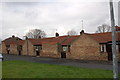
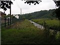
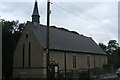
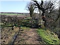
Area Overview for Low Westwood
Photos of Low Westwood


Area Information
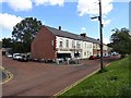
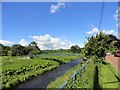
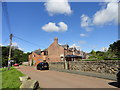
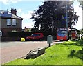
Living in Low Westwood offers a distinct experience within a built-up area defined by its compact size. The settlement covers 29.3 hectares, creating a defined environment for its residents. You will find yourself in a locality that functioned as a town or city centre historically, though the current population dynamic tells a different story. The median age here is 70, which fundamentally shapes the character of daily life. This demographic profile suggests a community where the older generation holds significant sway over local activities and housing demand. While the area code designates it as a major settlement type, the real-world experience is dominated by specific resident needs rather than the bustle associated with younger urban centres. Prospective buyers considering homes in Low Westwood must weigh the quiet, settled nature of this place against their personal requirements. The concentration of elderly residents means that amenities and services are likely tailored to an older demographic. You are looking at a specific slice of County Durham life where the pace is determined by these demographics. The area's identity is anchored by its historical classification rather than recent population growth. Understanding this context is essential for anyone visualising their future in a neighbourhood that has remained relatively stable in terms of age and settlement type.
- Area Type
- Built Up Area 250
- Area Size
- 29.3 hectares
- Population
- Not available
- Population Density
- Not available
Your daily convenience in Low Westwood is supported by a practical range of amenities within practical reach. You have access to four railway stations nearby, including Prudhoe Station, Stocksfield Railway Station, and Wylam Station. These rail links provide essential connections for those who wish to travel beyond the local area. Retail options are present but limited in number, with five main outlets identified. These include Co-op Chopwell, Co-op Leadgate, and Morrisons Daily. These specific venues serve the immediate needs of grocery shopping and daily essentials. While you will not find a high-street experience with multiple dining choices or entertainment venues, the key stores ensure you can manage your weekly food shopping without significant travel. The proximity to these rail hubs and supermarkets means you have the core necessities close to the 29.3 hectare boundary. Living in Low Westwood means accepting that leisure and shopping trips are somewhat condensed into these specific locations. The lack of additional retail categories suggests a focus on basic requirements rather than a luxury or experiential lifestyle. You will find the functional needs of daily life are met by these established outlets, provided you do not seek a wide variety of dining or specialised retail experiences.
Amenities
Schools
| Rank | School | Type | Entry gender | Ages |
|---|
Explore more schools in this area
Go to Schools tabDemographics
The community profile of Low Westwood presents clear demographic realities. The median age of 70 confirms that this is largely an area inhabited by seniors. Most residents fall within the older age brackets, a fact that defines the social fabric of the locality. You are entering a neighbourhood where the majority of the population shares a similar life stage. Home ownership stands at 72%, indicating that three quarters of households own their properties outright or have a mortgage. This high rate of ownership suggests a stable, long-term resident base. The data shows the household composition and accommodation types as total figures, implying no specific breakdown of family versus single-person homes is currently isolated in this dataset. However, the high ownership percentage strongly correlates with the older age profile, as retirees often own their homes. Ethnic and religious diversity figures are listed as total, meaning the specific breakdown of faiths and ethnic groups is not detailed in the available information. This lack of specific detailing does not change the fact that the area is dominated by the older demographic. Deprivation levels are not explicitly scored in the provided information, so any assessment of economic hardship must rely on external knowledge. The primary demographic takeaway is an older, predominantly owner-occupied community living within a 29.3 hectare zone.
Household Size
Accommodation Type
Tenure
Ethnic Group
Religion
Household Composition
Age
Household Deprivation
NS-SEC
Explore more demographic insights in this area
Go to Demographics tabPlanning
Planning Constraints
- Crime RiskPremium