Area Overview for Linthorpe Ward
Photos of Linthorpe Ward
Area Information
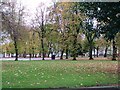
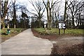
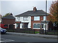
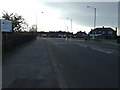
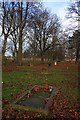
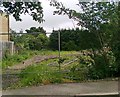
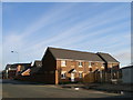
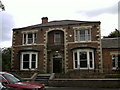
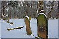
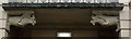
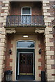
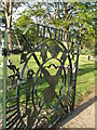
Linthorpe Ward is a distinct neighbourhood situated within the Borough of Middlesbrough in North Yorkshire. This small yet established district covers a total area of just 1.2 km². It functions as a Victorian suburb with wide, tree-lined avenues that developed from late 19th-century farmland. The location is central, bordered by Acklam, Ayresome, Grove Hill, Middlesbrough town centre, and Whinney Banks. Residents derive their history from a settlement originally recorded as Levynthrop, situated near a probable Roman route. Prince Arthur opened Albert Park in 1868, creating a green space that remains a key feature of the area today. Middlesbrough Football Club formed in the ward in 1876, initially playing home matches at Albert Park. The community includes civil parish history dating back to 1866, when the population stood at 438. Although administrative boundaries have shifted recently, the ward remains a defined electoral unit. Living in Linthorpe Ward means residing in an urban residential area with a layered history. You are close to Middlesbrough town centre and have access to routes connecting to the wider region. The ward contains significant heritage sites including Sacred Heart Church and the Linthorpe Hotel. Driving through Linthorpe Road, you pass through a designated Conservation Area that protects its special architectural interest. The local environment includes Linthorpe Cemetery, which once served as a village green for the original settlement. Daily life here is shaped by these historic structures and the proximity to nearby developments like Ayresome.
- Area Type
- District Borough Unitary Ward
- Area Size
- 1.2 km²
- Population
- Not available
- Population Density
- Not available
Demographics
The community profile of Linthorpe Ward is defined by an older population compared to national averages. The median age for residents is exactly 70 years. This age structure reflects a district where households are often occupied by retired individuals or those with long-term community ties. Home ownership stands at a high rate of 75% within the ward. This figure suggests that the majority of households in Linthorpe Ward buy rather than rent their properties. The demographic data indicates a stable residential pattern where residents have deep rooted connections to the locality. You will find that the area appeals to those seeking independence rather than families seeking child-centric amenities. The high ownership percentage also influences local investment priorities and community engagement. Residents in Linthorpe Ward tend to prioritise low-maintenance living suited to an older age profile. The ward's character as a Victorian suburb further supports this demographic trend, with many properties designed for single households. As you consider homes near Linthorpe Ward, expect an environment dominated by older adults. This age distribution impacts local service needs and social activities available. The 75% ownership rate offers security for long-term residents who wish to stay in Linthorpe Ward for the rest of their lives.
Household Size
Accommodation Type
Tenure
Ethnic Group
Religion
Household Composition
Age
Household Deprivation
NS-SEC
Explore more demographic insights in this area
Go to Demographics tabPlanning
Planning Constraints
- Flood RiskPremium
- Ramsar Wetland SitesPremium
- Area of Outstanding Natural BeautyPremium
- Protected Nature ReservePremium
- Protected WoodlandPremium
- Crime RiskPremium